“East or west” guides compare scenery, which is exactly why they never decide anything: both halves of Crete have gorges, pale-sand beaches, Venetian old towns and a wild south coast. The question does have an answer — but it lies elsewhere: in the airport your flight lands at, in the rainfall, and in the 286 kilometres between the island’s two ends. All three figures are public, no guide puts them side by side, and together they give a clear answer — including for the traveller who, trying to be clever, bases themselves right in the middle.
💶 Transparency: this article contains partner links. If you book through one of them we earn a commission at no extra cost to you. It changes nothing in our recommendations, and wherever a free or official option exists we name it before the link.
The question is asked the wrong way round, which is why it never gets answered
Open ten “east or west Crete” guides and ten times you will be shown scenery. Ten times the conclusion will be the same — it depends what you’re looking for. It cannot be otherwise, because the two halves are far more alike than anyone admits: each has its gorges, its pale-sand beaches, its mountain villages, its wild south coast and its Venetian old town. Comparing their beauty means comparing like with like, and therefore deciding nothing.
The right question is not “where is it prettier” but “what does this choice cost me”. And there, three numbers settle it — none of them about beaches.
The first is the length of the island, and it rules out the easy answer straight away. Chania to Sitia is 286 kilometres and about four and a half hours of driving. Going from one end to the other and back is 572 kilometres: across a week, two full days in the car. Crete is not an island you drive through, it is an island you settle into. So you have to pick a side — and that is exactly what the rest of this article is for.
Two things before the numbers. First, “east” and “west” are not official boundaries: here “west” means everything orbiting Chania and Rethymno, and “east” everything orbiting Agios Nikolaos, Ierapetra and Sitia. Second, whichever side you pick, a car is not optional: outside the main towns buses exist but set your timetable, and most of the places in this article sit at the end of roads nothing serves. Comparing Crete’s local rental companies gives you a sense of island prices before you settle anything else — and it weighs more heavily than the hotel difference between the two sides.
First number: your flight has already answered
This is the figure nobody looks at, and it is the most decisive of the three. Crete has two international airports, and they are not in the same league.
Heraklion handled 10,033,151 passengers in 2025, up almost 7 %. Chania handled 4,150,829. In other words, 71 % of the passengers using the island’s two international airports go through Heraklion. As for Sitia, out east, do not count on it: no scheduled international flights land there — domestic routes to Athens and a few islands, and that is all.
Now lay that over the map. From Heraklion, the east starts 65 kilometres away — Agios Nikolaos, an hour on the fast road. The west starts 138 kilometres away — Chania, two hours. From the airport where seven travellers in ten land, the east is twice as close as the west, a gap of 73 kilometres on the first evening’s drive alone.
There is a paradox here worth stating plainly: most visitors land on the side they will not be visiting. That is not a mistake in itself — if you have come for Balos and Samaria, two hours of driving is the ordinary price of admission. But if you are still undecided, know that your plane ticket has already put a thumb on the scale, and it has put it on the eastern side.
Two practical consequences. If you choose the west, look for a Chania flight first: the choice is narrower and often slightly dearer, and it saves you four hours of driving across the trip. If you land at Heraklion in the evening, do not plan to collect a car and drive two hours in the dark on arrival day: a transfer booked in advance from Heraklion airport settles the first evening at a known price, the driver tracks the flight number, and you pick the car up rested the next morning. For a daytime arrival and a nearby base, the public bus does the job for a few euros, and we would rather say so before suggesting anything else.
Second number: the rain, which divides the island far more than the scenery does
Here is the figure missing from every comparison, and probably the most useful thing in this article. Chania gets around 869 millimetres of rain a year. Ierapetra, on the south-east coast, gets around 303. That is nearly three times less in the east.
The reason is simple and visible from the plane: the White Mountains in the west rise above two thousand metres and block the fronts coming in from the north-west. They wring the clouds out on their own slopes, and whatever gets past arrives dry. Ierapetra, in their shadow at the island’s southern tip, is in fact given by the Greek meteorological service as the warmest and sunniest town in Greece — and as the southernmost in Europe.
In July and August this number is useless: it rains nowhere in Crete, and both sides will give you thirty sunny days out of thirty. The rest of the year it decides everything. In April, May, October and November the gap does not show on the thermometer — temperatures are close — but in the number of usable days: the ones where the hike is not called off, the beach is not being scoured by wind, and the mountain road is not in cloud.
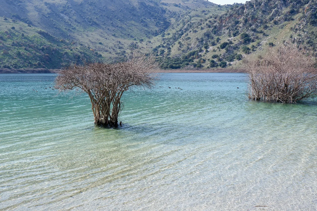
The figure has a flip side, and honesty requires giving it: the west is green because it is watered. Lake Kournas, the deep gorges, the wooded plateaus, the dense olive groves and the rivers still running in June are a direct consequence of those 869 millimetres. The east is mineral: bare hills, dry ravines, ochre and white. That is not worse, it is different — and if you want greenery, the number argues against the east.
What the west has that the east does not
The west fits in one sentence: it has the images. The three or four landscapes in your head when you think “Crete” are all there.
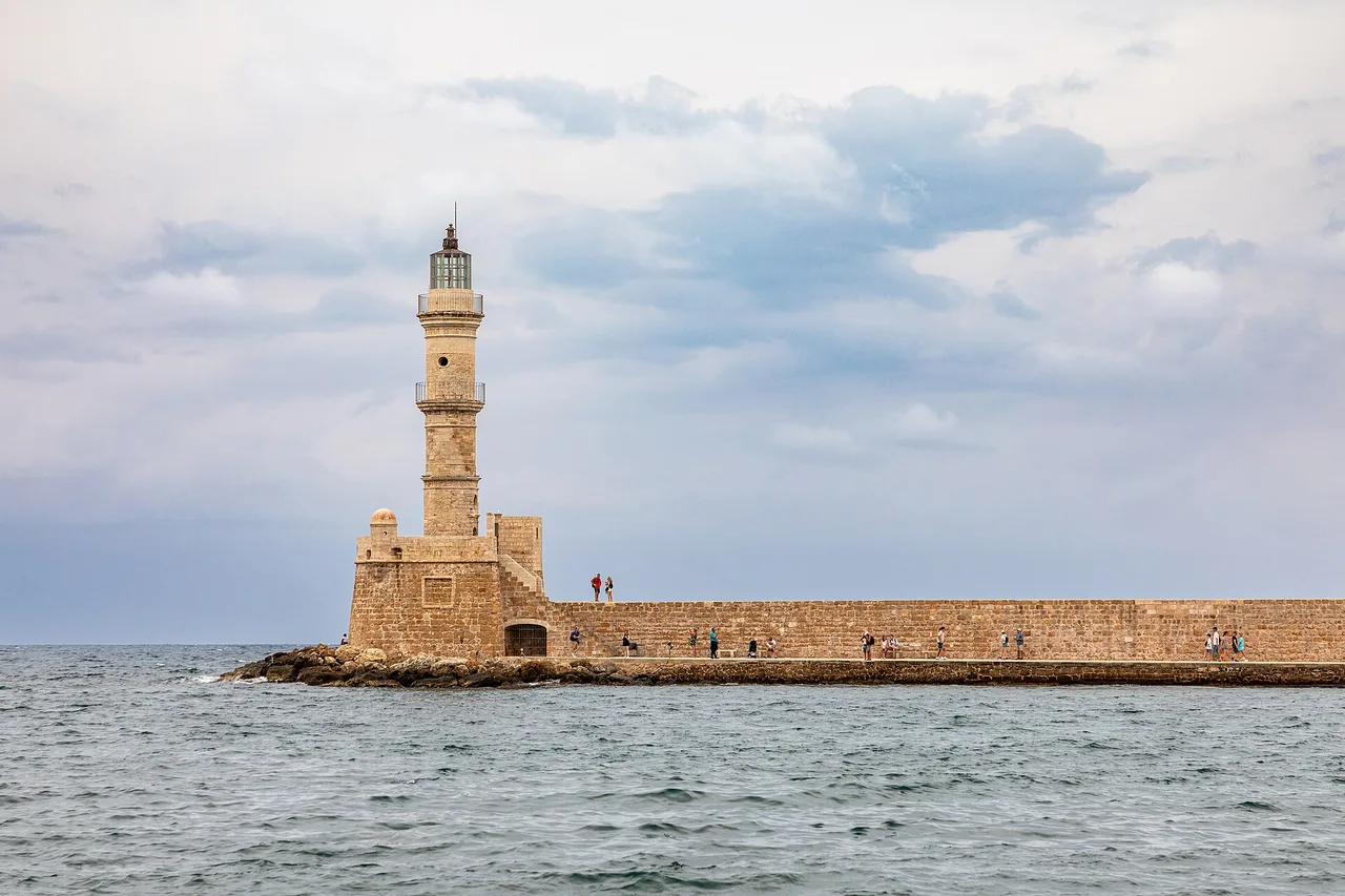
Balos, the white-sand lagoon at the end of nine kilometres of dirt track. Elafonissi and its pink-tinged sand, regularly ranked among Europe’s finest beaches. The Samaria Gorge, sixteen one-way kilometres that come out at a village with no road. And Chania, whose Venetian harbour, arsenals and lighthouse make it the island’s loveliest old town — the one you actually want to have dinner in every evening, which matters more than you would think across seven days.
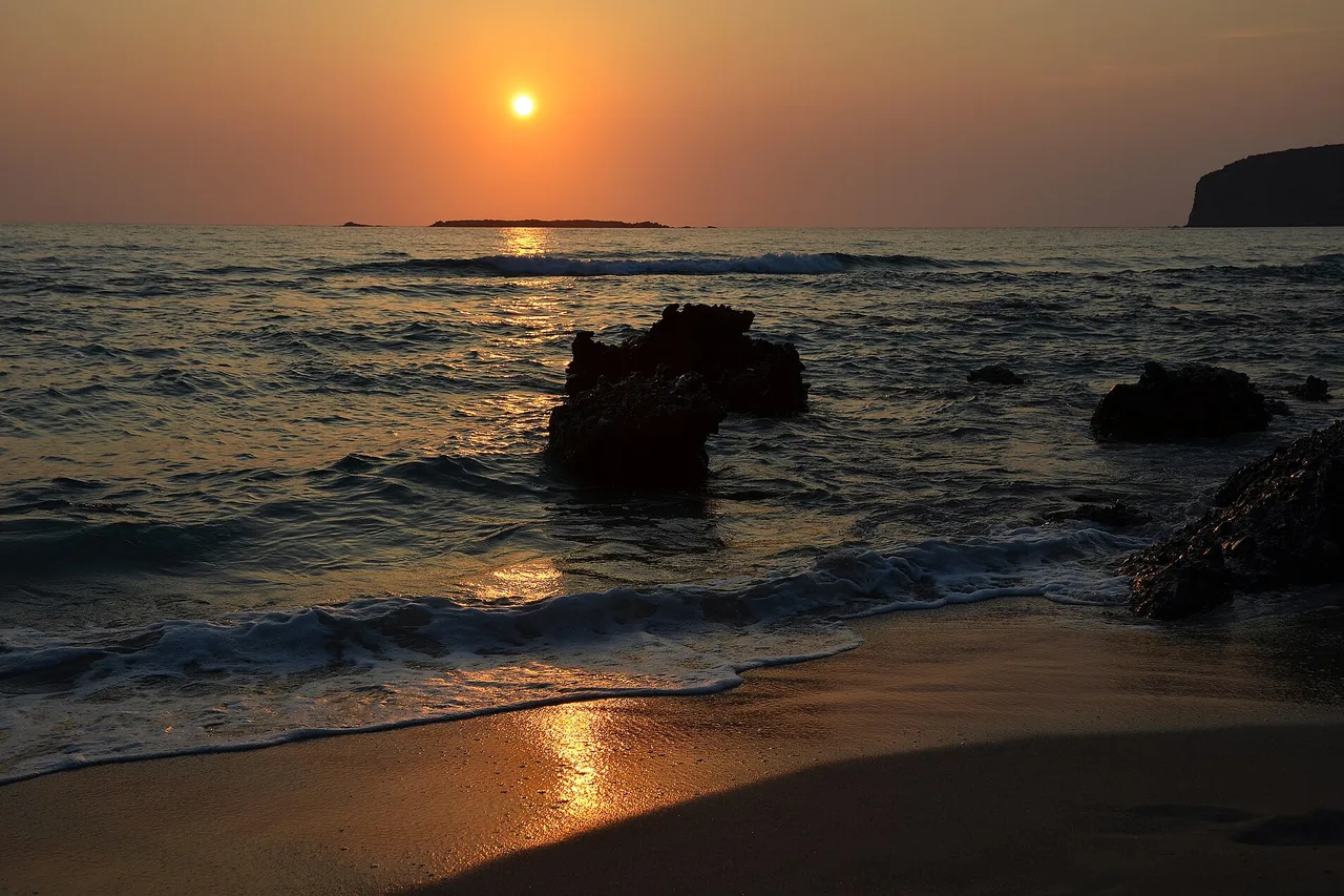
The west also has a physical fact the east will never have, and which no comparison mentions: at the western tip, the sun sets into the sea. Falassarna and the Gramvousa peninsula face due west, and sunset there is a daily event you organise the end of your day around. In the east the sun rises out of the sea and sets behind the mountains — a different, early-morning light that many travellers never see, because they are asleep.
The price of those images is mechanical: they are shared. The Balos car park is full by ten in July and August, Elafonissi fills through the morning, and Samaria is a one-way route walked by several thousand people a day at peak season. If you are coming in August to escape the crowds, the west will not help you: it concentrates them.
What the east has that the west does not
The east does not sell itself on images, because it has few. It sells itself on three things that exist nowhere else on the island, plus a fourth that cannot be photographed.
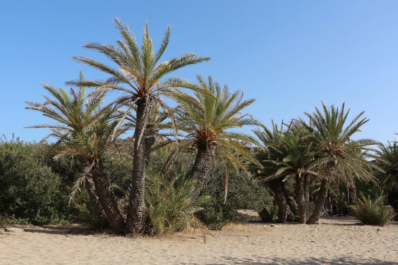
Vai, first: Europe’s largest palm grove, about 25 hectares and, depending on the source, between 4,500 and 6,000 trees. These are not planted palms but an endemic species, Phoenix theophrasti, protected under Greek law, the Bern Convention and the EU Habitats Directive. The grove has been classed as an “aesthetic forest” since 1973, is fenced, and opens in daylight hours only: you walk alongside it from the beach, you do not wander through it. That is a constraint, and it is the reason there is still something to look at.
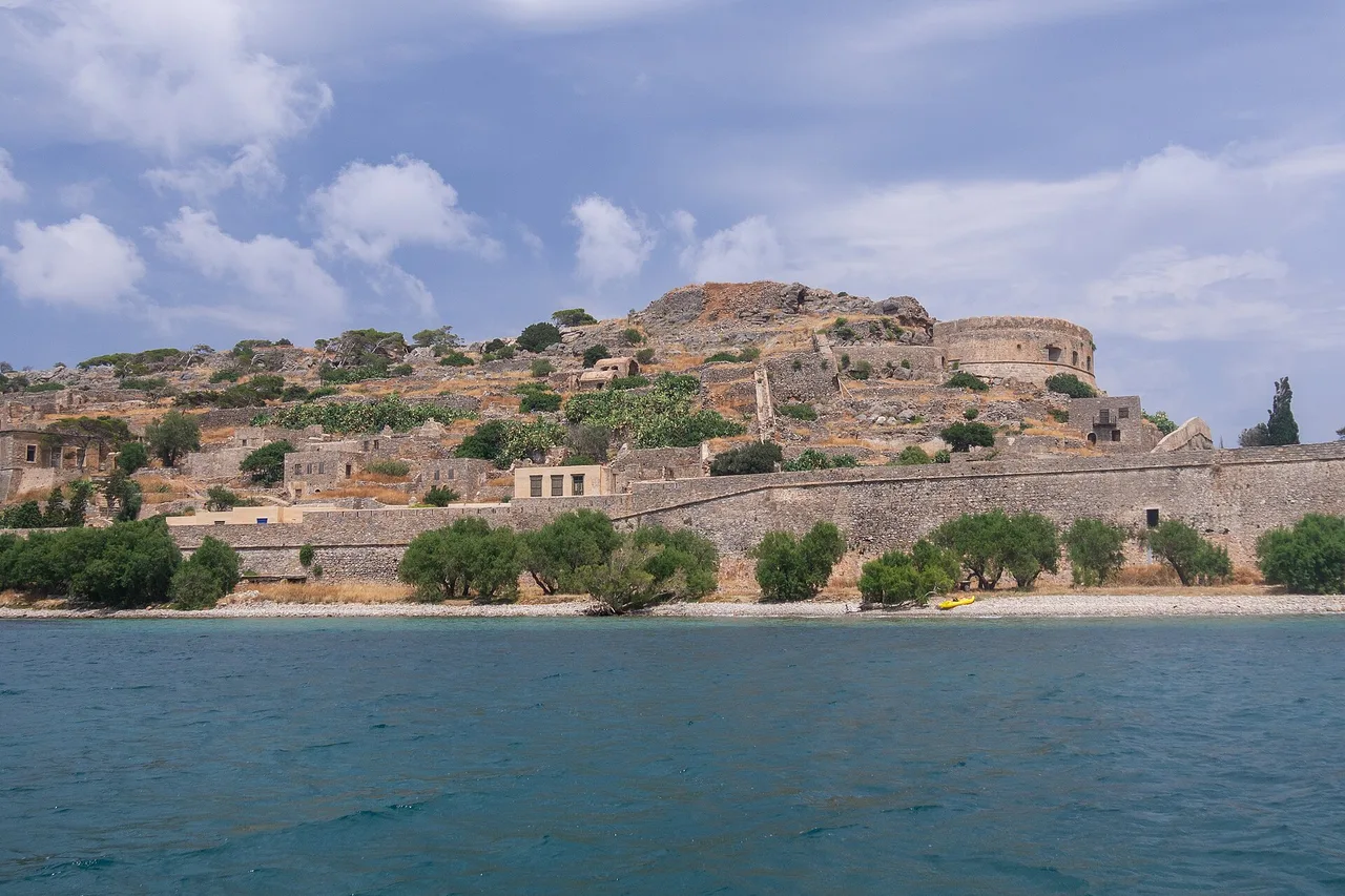
Then Spinalonga, the fortified islet in Elounda bay: a Venetian fortress, then a leper colony until the middle of the twentieth century, today the most visited site in Crete after Knossos. One practical detail the guides skip: you pay twice, at two different desks — the crossing first, the island entrance second. And the departure port changes both price and duration: as noted in September 2026, expect around €12 from Plaka for a ten-minute crossing, €14 from Elounda for about twenty minutes, €16 from Agios Nikolaos; island entry runs around €20, half that at the reduced rate. Boats every thirty minutes from nine to five. These are orders of magnitude taken from booking sites, not an official published tariff: check them again before you go. The lesson will not change: leaving from Plaka is both the cheapest and the shortest crossing.
And the Lassithi plateau, a farming bowl perched at eight hundred metres, and the road that climbs to it. Plus the south-east: Xerokambos, Zakros, beaches where you find yourself alone on a September afternoon — which, in Crete, is not nothing.
The fourth thing cannot be photographed: the east drives better. The northern fast road reaches Agios Nikolaos in an hour from the airport, internal distances are short — 82 kilometres from Agios Nikolaos to Sitia, 101 from Heraklion to Ierapetra — and you cross far less mountain. In the west, any trip south is a mountain pass.
The compromise trap: basing yourself in the middle
Faced with this dilemma one answer comes naturally: I’ll base myself in the centre, in Heraklion, and radiate out both ways. It is the most common reasoning, and it is the worst. The numbers say so without ambiguity.
Heraklion is 138 kilometres from Chania and 147 kilometres from Sitia. 9 kilometres apart: to within a few minutes, the island’s exact centre of gravity. And a centre of gravity has an unpleasant property — it puts everything equally far away. From Heraklion, Balos is over two and a half hours, Vai nearly three, Elafonissi three. Every famous sight becomes an excursion that eats the whole day, and the week is spent on the fast road.
None of which means Heraklion is worthless — quite the opposite. The centre has Knossos, five kilometres from town, and the archaeological museum holding the Minoan collections: visit the two together and you have the island’s best cultural day. An audio guide to Knossos and the old centre saves you from following a group while still understanding what you are looking at — and on a site as reconstructed as Knossos, that is the difference between walls and a story.
Our advice: treat the centre as a stop, never as a base. A day or two on arrival or departure, when you are near the airport anyway — then head for the side you chose.
So who goes west, and who goes east?
Here is the answer, with no “it depends”.
Go WEST if: it is your first trip to Crete and you want to see what you have seen in photographs · you are travelling in July or August and will accept crowds in exchange for the headline sights · you hike, and you want Samaria · you like green landscapes, deep gorges and mountains over two thousand metres · you are travelling without a car and want a real town to walk out to dinner in every night, Chania being the island’s best for that.
Go EAST if: you are travelling outside high season, where the 2.9-to-one rainfall gap becomes your strongest argument · it is your second trip to Crete · you want beaches where you are alone rather than beaches that are famous · you land at Heraklion and have no wish to start with a two-hour drive · you are travelling with children and prefer short hops to mountain passes · you have come for archaeology and history as much as for the sea, with Spinalonga, Zakros and the Heraklion museum within reach.
And if you are still hesitating, decide on the one criterion that never lies: the date. June to September, the west. October to May, the east. That is not a matter of taste, it is the three-to-one rainfall ratio applied to your calendar — and it does not argue back.
What if you really want both?
It can be done, on one condition: you need the time. Here are the three formats that work, and the one that does not.
What does not work: one week split down the middle. You will spend 572 kilometres on transfers and two half-days packing, and you will skim both sides without knowing either. Seven days do not divide.
What works, format A: ten days, split unevenly. Six nights on one side, three on the other, treating the second part as a bonus rather than a second half. Land on one side and fly home from the other if the flights allow — Chania in, Heraklion out, or the reverse: that is what removes the return leg, and therefore half the cost.
Format B: two weeks, a real split. One week west, one week east, a single crossing between them, and Rethymno or Heraklion as a halt on transfer day. It is the most comfortable way to know the island, and the only one that does both halves justice.
Format C: two trips. This is our favourite, and it is not a cop-out. Crete is over two hundred and fifty kilometres long and holds fifty-three sites protected under the European Natura 2000 network, close to a third of its surface. You do not see it in one go. The west in summer for the headline sights, the east out of season for the quiet and the sun: two trips that feel nothing alike, on the same island.
One last word on the car, since it decides everything else. Wherever you go, book it before you travel, especially in July and August: an island’s fleet is finite by nature, and the last vehicles available go at a premium. And book small: Cretan mountain roads are narrow and often walled, and one category down will make your week easier — on both sides of the island.
When it comes to booking. Guided tours, entry tickets and dated excursions: see activities in Crete — these are the slots that run out first in high season. A partner link; your price is unchanged.