Piton de la Fournaise, at 2,632 metres, is one of the most active volcanoes on the planet — and one of the very few you can approach on foot, on waymarked trails, without being a mountaineer. You just need to know which way to go up, at what time, and what you are allowed to do depending on the volcano's mood: access changes several times a year, at the rhythm of the eruptions. Here is the complete guide, written by locals: the volcano road, the hike from Pas de Bellecombe to the Dolomieu viewpoint, this year's access rules and the right way to watch an eruption. The volcano and everything around it are among the 160 spots of the free app, with the day's weather zone by zone.
Understanding La Fournaise: a volcano you can walk on
If hiking on such an active volcano is possible at all, it is because La Fournaise is an effusive volcano: its fluid lavas pour out as flows and fountains, without the great explosions of grey volcanoes. Most eruptions happen inside the Enclos Fouqué, a horseshoe-shaped caldera open to the ocean, which the trails overlook from its ramparts. That is the sight waiting for you at Pas de Bellecombe: a desert of frozen lava eight kilometres wide, with the summit cone in the middle.
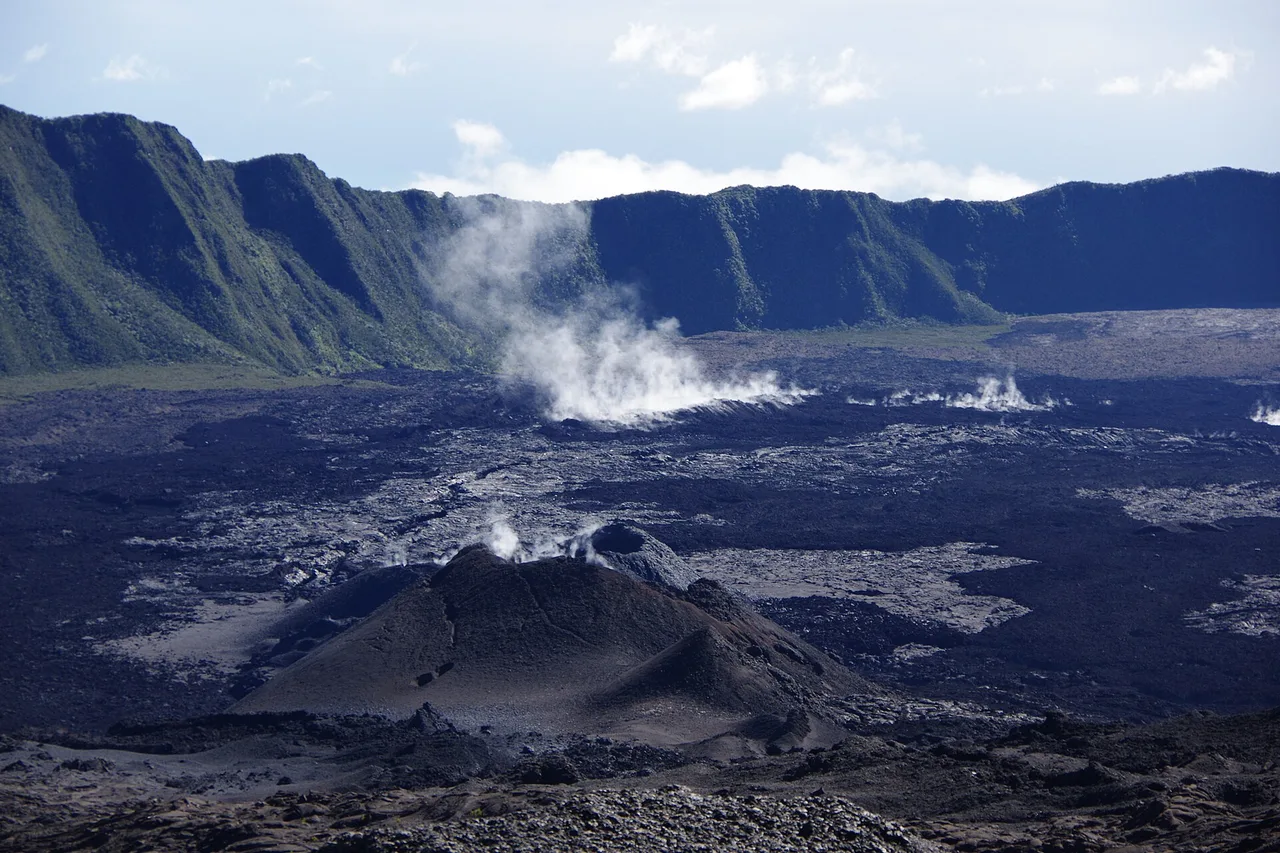
The volcano is monitored around the clock by the Piton de la Fournaise Volcanological Observatory, and access is regulated by the prefecture: as soon as an eruption looms, the enclosure closes; when the volcano settles down, the trails reopen, sometimes partially. The last eruption began on 13 February 2026 and ended in early spring; since 7 May 2026 the volcano has been in the vigilance phase and the enclosure is partially reopened. Our Réunion Island page lays out the island's regions and where to stay to be in the right place the night before your climb.
The volcano road: the drive is already the destination
Everything starts at Bourg-Murat, on the Plaine des Cafres, where the volcano forest road leaves the RN3. This is also home to the Cité du Volcan, the museum dedicated to La Fournaise: a good first stop to understand what you will see up there — and an excellent rainy-day plan B. The road then climbs for some thirty kilometres, and every lookout deserves a stop: the Nez de Bœuf overlooks the deep valley of the Rivière des Remparts, then the Commerson crater opens its dizzying pit right by the roadside.
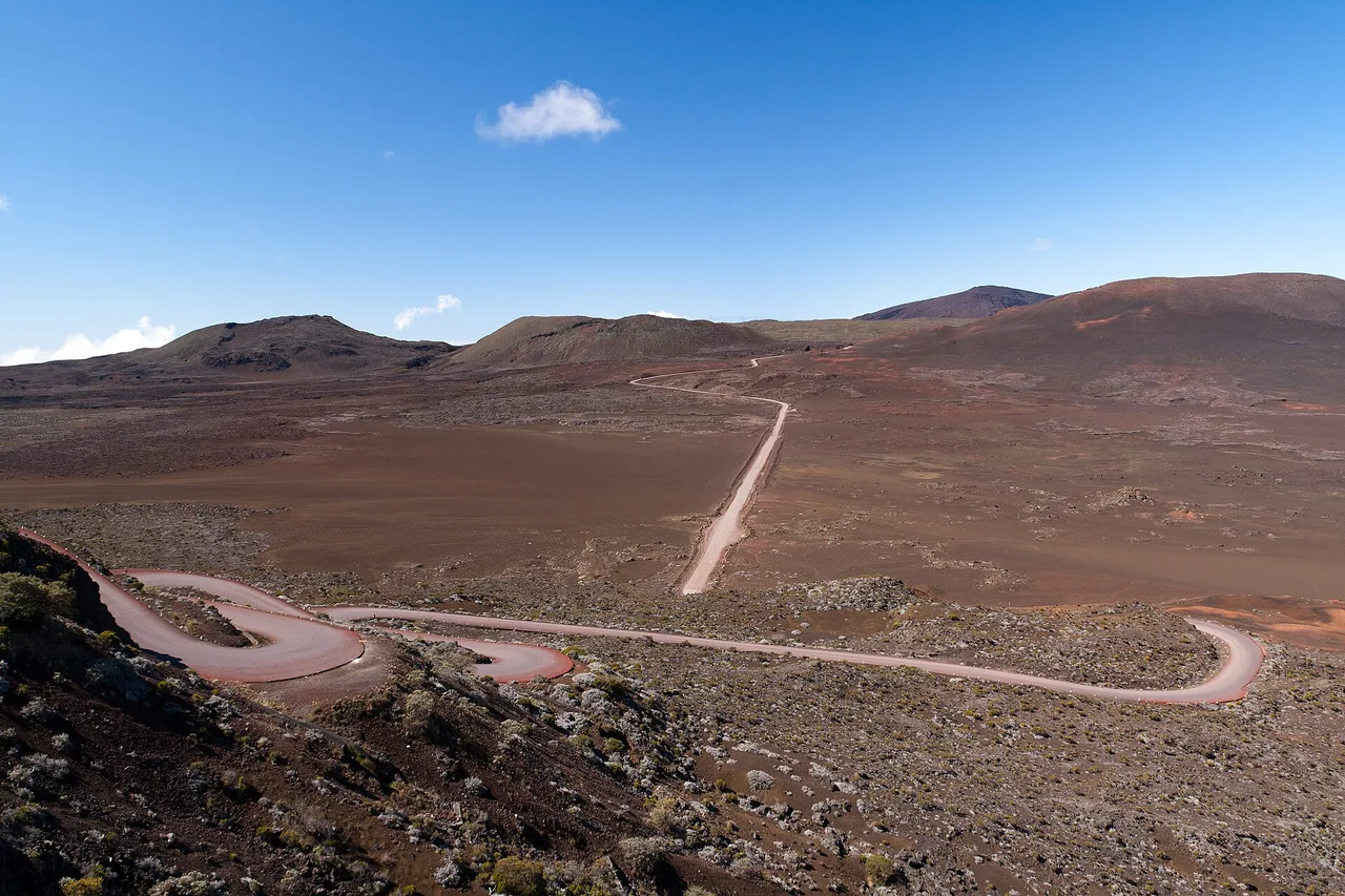
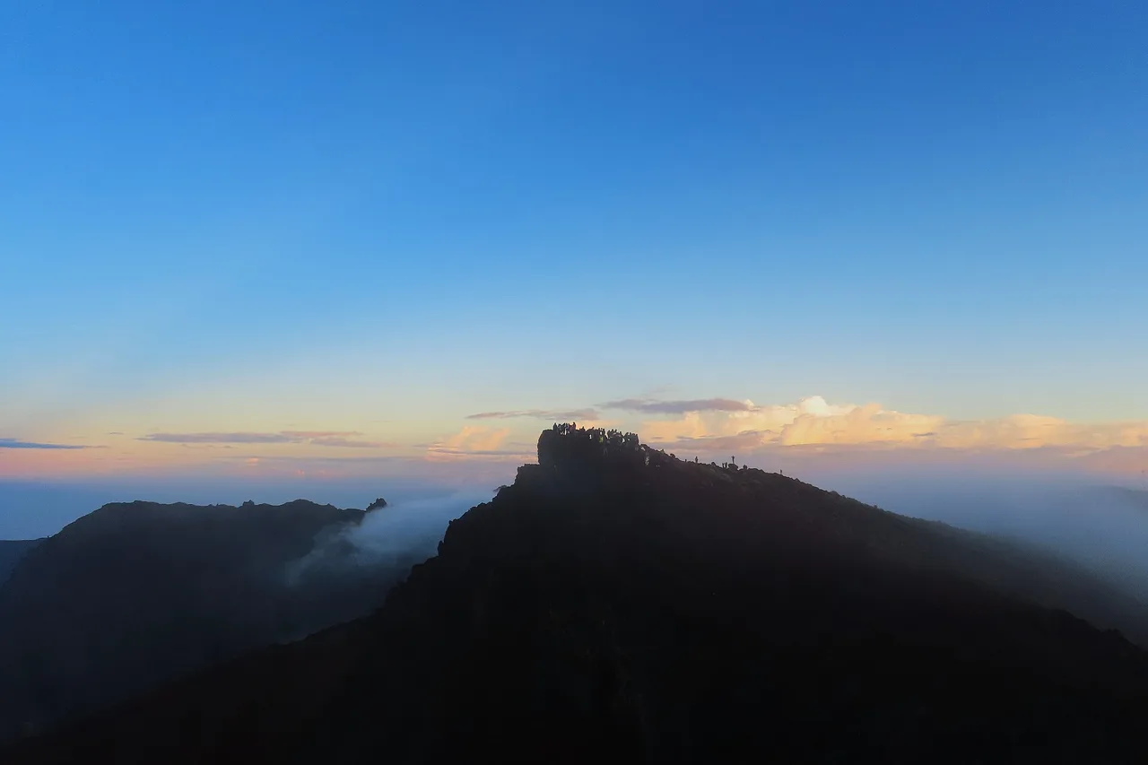
Then comes the moment nobody forgets: at Pas des Sables, the road tips over into the Plaine des Sables, a desert of ochre and black cinders that the track crosses dead straight. Stop, cut the engine, walk for ten minutes: the silence is total. The road ends at Pas de Bellecombe, above 2,300 metres, facing the enclosure. The Gîte du Volcan nearby lets you sleep on site and reach the rampart before sunrise.
The hike: from Pas de Bellecombe to the Dolomieu viewpoint
The classic route is about 12 km return, with 5 to 5.5 hours of walking and some 550 metres of climbing. You first descend the rampart by a staircase cut into the wall, pass the Formica Léo — that perfectly drawn little red cone —, then the trail crosses the lava flows to the Rosemont chapel, a lava bubble shaped like an oratory, before climbing steadily to the rim of the Dolomieu crater. The viewpoint overlooks a chasm more than 300 metres deep: the crater floor collapsed all at once in April 2007, leaving these dizzying stratified walls.
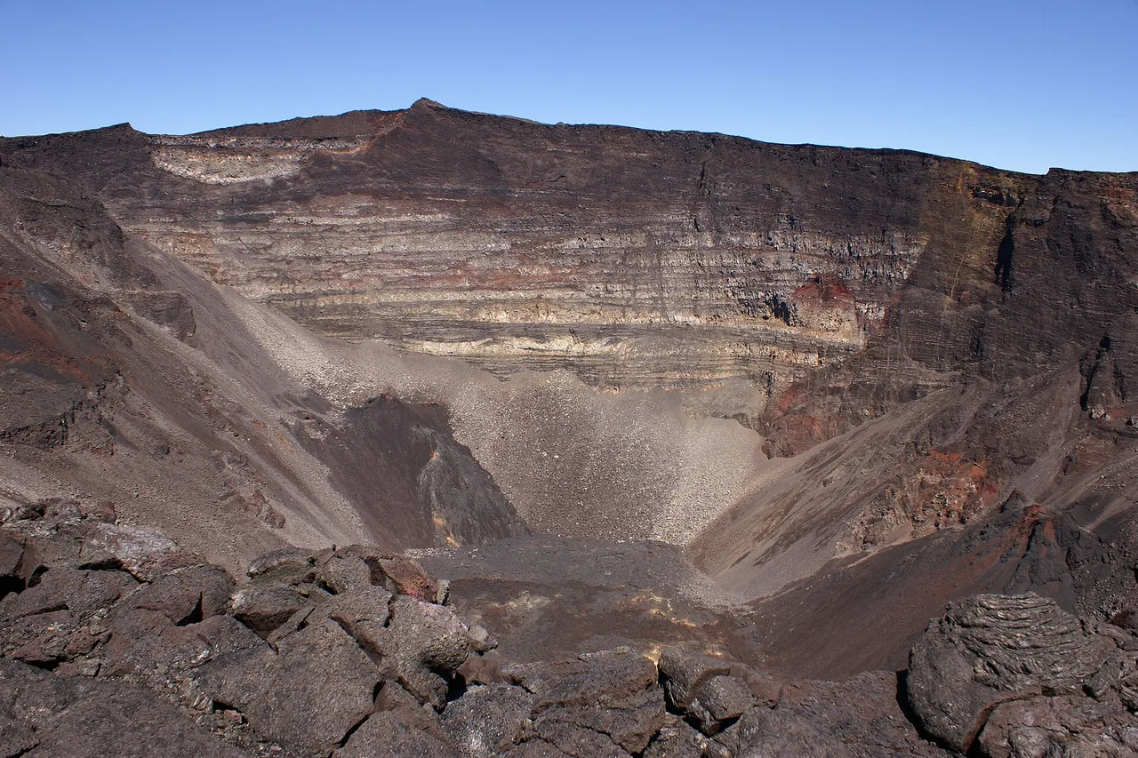
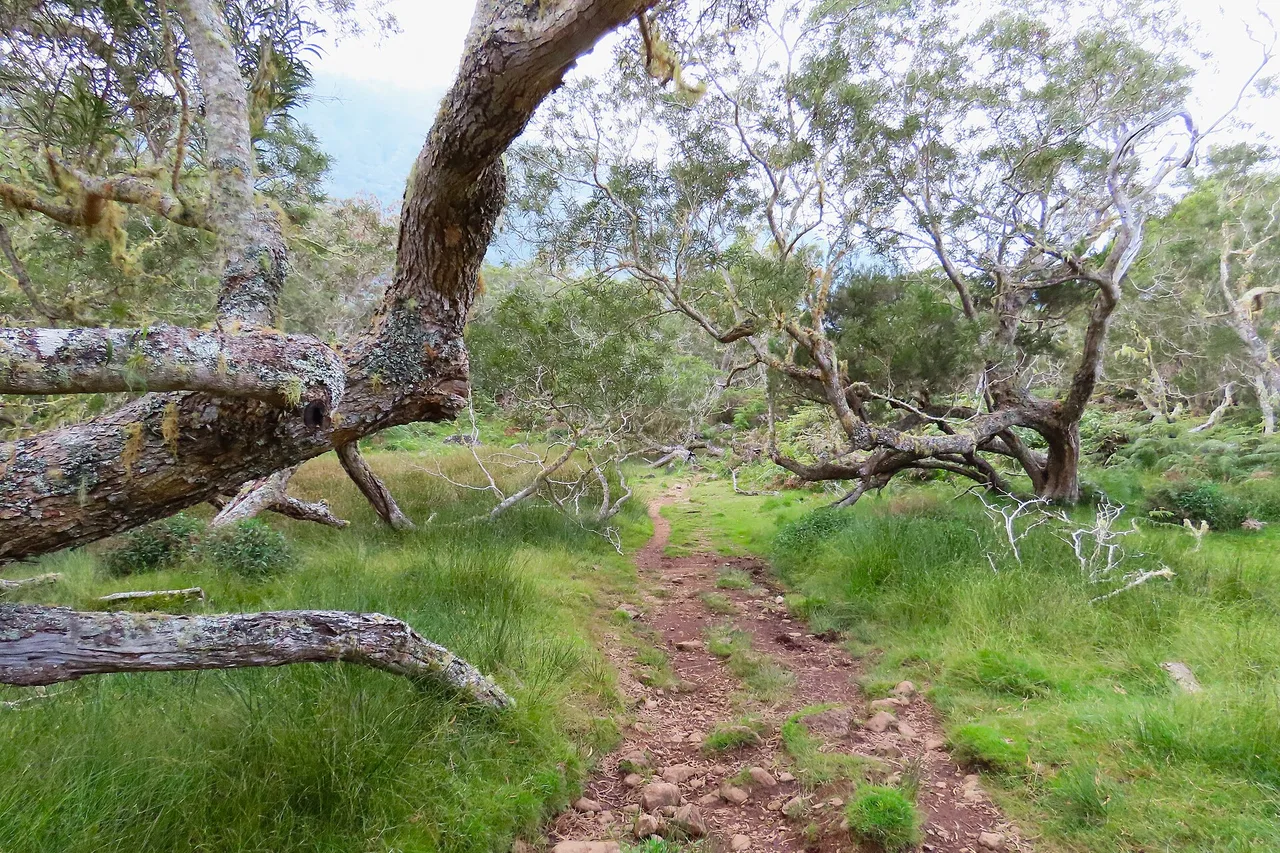
Since the partial reopening of the enclosure, only two routes are allowed in the upper section: the Rivals trail to the Caubet crater, and the trail to the Dolomieu observation site via the north. The Kapor trail remains closed, part of it being covered by the 2026 flow. The white marks painted on the lava are your lifeline: when the fog rolls in — and it rolls in fast — they are all that brings you back. To slot this day into your trip without driving the same road twice, the explorer map traces your road trip timed on real roads, from the coast to the Pas de Bellecombe car park.
Preparing your climb: weather, gear, common sense
The golden rule fits in one sentence: at the volcano, everything happens before 10 am. The sky is almost always clear at sunrise, then the clouds climb from the coasts and swallow the enclosure by mid-morning. Locals leave the coast at night to be at Pas de Bellecombe at dawn — which is also when the light on the Plaine des Sables is at its best. Second rule: it is cold, genuinely. Above 2,300 metres, early mornings in the southern winter drop below 10 °C, frost included, even when it is 25 °C on the beach you left.
In the bag: two litres of water per person — there is no spring and no shade in the enclosure —, a windproof layer, a fleece, a cap and sunscreen (altitude sun burns fast, even through haze), and proper walking shoes: lava is abrasive and loose underfoot. Before driving up, check the day's conditions for the Volcano zone: dawn temperature, wind, rain and the six-day forecast, zone by zone. And if your planned day looks socked in, the app's agenda moves the climb to the right slot of your week — the volcano deserves to be seen.
The volcano at the right moment
Live conditions for the Volcano zone, six-day forecasts, 160 spots checked in person: the free app tells you whether tomorrow is the day to go up.
Open the free app →Watching an eruption — and walking on the old ones
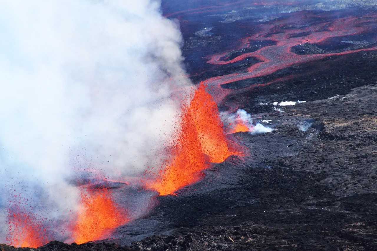
When La Fournaise erupts, the enclosure closes immediately — but the show does not disappear: it is watched from the high points outside the enclosure, on the rampart, such as Piton de Bert, where Réunionese families head up with thermos flasks and blankets. At night, when the lava fountains set the sky ablaze, you understand why the whole island turns out. If an eruption happens during your stay, respect the closures to the letter: they follow the volcano's actual activity, not some abstract precaution.
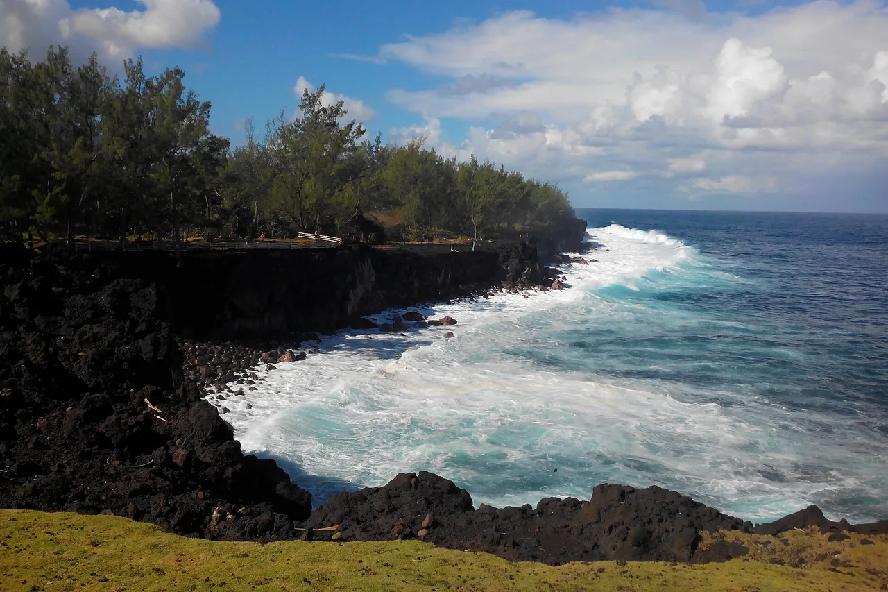
The rest of the year, it is the traces of past eruptions that you visit. At the Grand Brûlé, the lava road runs along the flows that crossed the RN2 on their way to the ocean — you literally drive between cooled lavas, including the 2007 flow. The Sentier des Laves, starting from the RN2 via the Grand Cap fisherman's path, leads to the northern edge of the 2026 flow. And the lava tunnels of the 2004 flow, reopened since 6 May 2026, can only be explored with a professional guide: beneath the surface, the lava has carved galleries with glazed walls that rank among the finest in the world.
One last planning tip: the volcano pairs beautifully with the wild south. Go up at dawn, drive back down the RN3 in the early afternoon, and keep the end of the day for the lava road or a vanilla plantation around Saint-Philippe. Also remember to fill up — fuel and picnic alike — before leaving Bourg-Murat: beyond it there is no petrol station and no shop, and the day is long between a night-time departure and the return to the coast.
Full guide: Renting a Car on Réunion Island: Tips and Pitfalls
A local's word
La Fournaise is earned, and respected. Three reflexes make all the difference: leave at night to arrive at dawn, give up without regret if the fog is already there — the volcano will still be here tomorrow, your weather window will not —, and never leave the waymarked trails, not for a photo, not to take a shortcut. The volcano's accidents almost all tell the same story: someone who left the white marks.
And keep a record of your climb: the app's travel journal keeps your spots, notes and photos — from the first bend of the Plaine des Sables to the Dolomieu viewpoint.
The real Réunion, in your pocket
The interactive explorer map: 160 spots checked on the ground, live weather zone by zone and road trips timed on real roads. Free, no account, no card.
Discover Moris Insider →