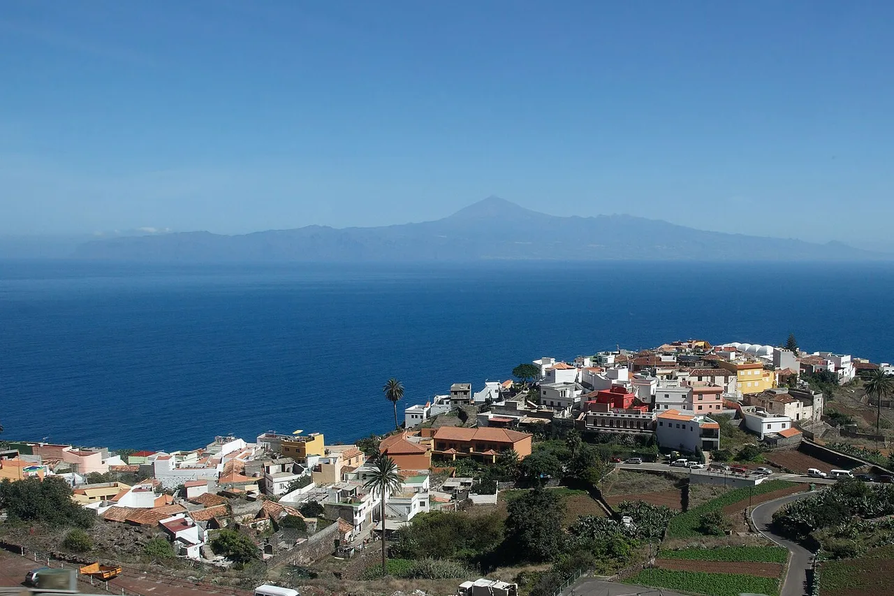
Tenerife packs 2,034 km² with a beach you can swim at all year round and a 3,715-metre volcano — the highest point in Spain — less than two hours apart by road. A lunar national park, cliffs of up to 600 metres dropping into the Atlantic, a laurel forest millions of years old, UNESCO-listed towns and whales visible all year round. The classic first-trip mistake is staying in your southern resort and believing the island is its hotel complexes. Here are the 25 things we genuinely recommend, in the order you should visit them — and every one of them sits on the 196 spots in the free app, with access details and today’s weather.
Read the island before you drive it
Tenerife works in two halves. The north, facing the trade winds, is green, humid and agricultural: that is where the banana plantations and vineyards grow, and where the historic towns stand. The south, sheltered by the mountains, is dry and sunny almost all year: that is where the resorts cluster. In between, Teide makes its own weather — it is quite normal to have 26 °C in Los Cristianos, a cloud lid over La Orotava and freezing blue skies at 2,300 metres, all on the same day.
Full guide: North or South: Where to Base Yourself in Tenerife
That relief imposes one simple rule: never judge the island’s weather from your hotel window. A calima day — that sandy haze blown in from the Sahara — is for museums and towns; a clear morning above the sea of clouds is made for the volcano. Our Tenerife page sums up the regions and what you will find in each; the general idea: sleep wherever you like, but cross the island — it changes face every twenty kilometres.
Teide National Park: five unmissables
1. The Teide cable car. In eight minutes it lifts you from 2,356 to around 3,555 metres, to the La Rambleta station, from which two viewpoints are freely reachable on foot — the Pico Viejo one looks over the south-west of the island and La Gomera. You really feel the altitude: walk slowly, and give it a miss if you have a heart condition or suffer from altitude sickness. 2. The summit, the real one. The peak’s crater — 3,715 metres — can only be reached via the Telesforo Bravo trail, which has a daily quota: a personal permit booked in advance on the official platform, with ID checked at the trailhead. Slots go weeks ahead in season; plan early, or aim for sunrise from La Rambleta, which requires nothing.
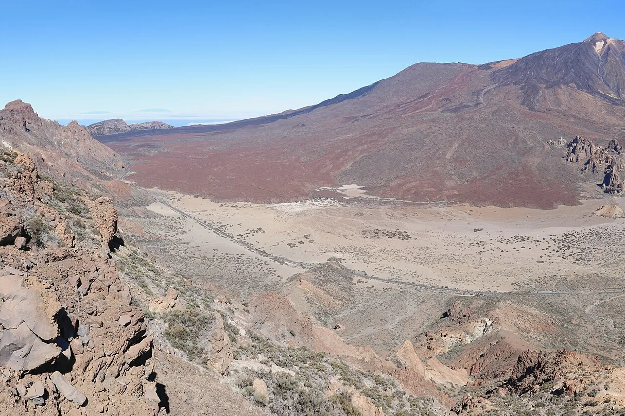
3. The Roques de García, a few minutes from the cable car, are sculpted lava columns — including the famous leaning Roque Cinchado posing in front of Teide — circled by an easy, spectacular trail of around ninety minutes to two hours. 4. The Las Cañadas caldera itself: the road crossing it is one of the most beautiful in Spain, between frozen lava flows, ochre sands and the cirque walls. Stop, walk ten minutes away from the car parks — the silence up there is mineral. 5. The starry night. The park’s sky is protected and among the purest in Europe — the Teide Observatory is not there by accident. Stay after sunset, or come back with a warm jacket: at 2,200 metres, nights are cold even in summer.
Full guide: Renting a Car in Tenerife: Pitfalls and Smart Tips
The volcano has its moods: wind that closes the cable car, ice on the high trails, clouds rising late morning. Before you set off, check the day’s conditions zone by zone: driving up to find the peak inside a cloud is the island’s most common disappointment — and its most avoidable.
The west: Masca, Los Gigantes, Garachico
6. The Los Gigantes cliffs. Basalt walls plunging several hundred metres into the Atlantic — the Guanches called them the “wall of hell”. Admire them from the village, from the black-sand Playa de la Arena, or better still from the sea, by kayak or boat. 7. The village of Masca, clinging 600 metres above a ravine in the Teno massif, is the most spectacular on the island; the narrow, vertiginous road up to it has to be earned — leave early, the tour buses arrive mid-morning.
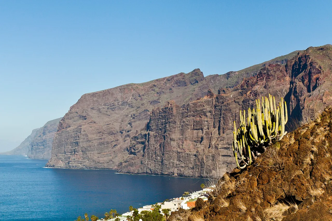
8. The Masca gorge. The canyon descent to the ocean is one of the finest hikes in the Canaries — and it is regulated: booking required on the official website, hiking boots checked at the entrance, children under 8 not admitted. Many hikers leave by boat towards Los Gigantes, turning the hike into an unforgettable loop. 9. Garachico, the island’s former main port destroyed by the 1706 eruption, has become one of its loveliest villages: cobbled squares, convents, and the El Caletón natural pools carved into the lava — swim only in calm seas; when the swell hits, the show is watched from the edge. 10. The dragon tree of Icod de los Vinos, emblem of the Canaries and said by legend to be a thousand years old, is worth the stop on the way back.
This west coast is best enjoyed by stringing viewpoints together at the right time of day. To get the order of stops and the real driving times, the explorer map plots timed road trips on the real roads — in the Teno massif, kilometres tell you nothing about the time they take.
Anaga: the forest from before mankind
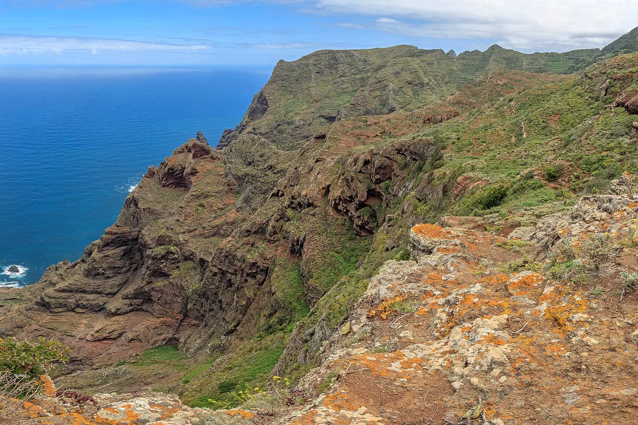
11. The Anaga laurel forest. At the north-eastern tip, the Anaga Biosphere Reserve protects a misty, mossy laurel forest inherited from the Tertiary era — the landscape that covered the Mediterranean basin millions of years ago. The trails from Cruz del Carmen dive under the canopy between ferns and twisted trunks; the Enchanted Forest trail (El Pijaral) is so popular it requires a free online permit. 12. Taganana and the north shore: the descent to this hamlet between the ridges, then the wild coast of Benijo with its sea stacks, make up one of the island’s great landscapes. 13. Chinamada, a troglodyte hamlet whose houses are dug into the mountain, is reached by a balcony trail above the ocean.
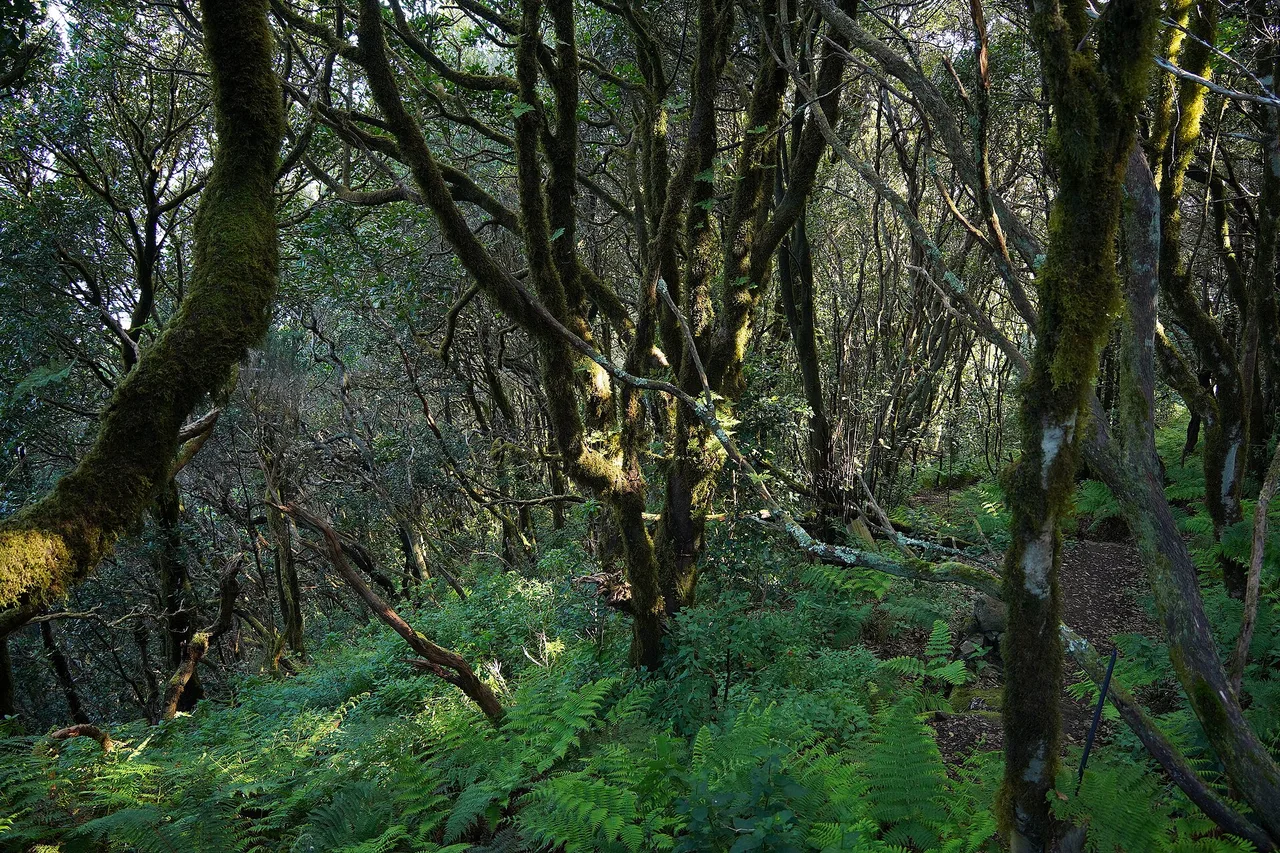
Anaga has to be earned: narrow ridge roads, frequent mist, and a striking contrast when you leave — twenty minutes later you are in the sun on the Santa Cruz seafront. Allow a full half-day, and shoes that do not mind mud.
Historic towns and balconies of the north
14. San Cristóbal de La Laguna, the former capital, is a UNESCO World Heritage Site: its grid plan served as the model for colonial towns across the Americas, and its streets line up colourful palaces, patios and convents — explore it on foot, ideally late in the day when the students give it back its real life. 15. La Orotava, above its valley of banana plantations, keeps the finest carved wooden balconies in the Canaries, Casa de los Balcones first among them. 16. Puerto de la Cruz, the grande dame of island tourism, mixes a fishing port, gardens and the Lago Martiánez, the seawater pools designed by César Manrique — the elegant local answer to a coast too powerful for free swimming. 17. Santa Cruz and its market: the capital is too often reduced to a shopping stopover; go instead to the Nuestra Señora de África market in the morning, then walk the seafront to the Auditorio.
The north is also where the island eats best — more on that below, guachinches oblige.
196 Tenerife spots, checked on the ground
Volcano, gorges, natural pools, beaches, local tables: every spot has its page, its access and today’s conditions. Free, no account needed.
Open the free map →Beaches: black sand, golden sand, and the northern rule
18. Las Teresitas, at the foot of the Anaga massif, is the island’s postcard: a bay of light sand imported from the Sahara in the 1970s, protected by a breakwater, family-friendly and lined with palms — the contrast with the mountains behind is unreal. 19. The southern beaches — El Duque, Las Vistas, Los Cristianos — offer comfort: light sand, sunbeds, generally calm water, services everywhere. The right address for families and rest days. 20. Benijo, the exact opposite: black sand, sea stacks rising from the ocean, not a single parasol — one of the most beautiful wild beaches in Spain. It is unsupervised and the currents are serious: swim close to shore, in calm seas, or not at all — the sunset, on the other hand, carries no risk.
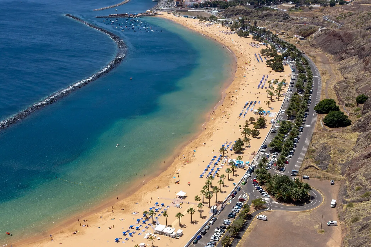
The golden rule applies to the whole north coast: the Atlantic there is magnificent and powerful. Unsupervised beaches, swell that rises fast, rip currents — every beach in the app shows its exposure and the day’s sea state, made precisely for choosing the right beach for the swell, not the nearest one.
The ocean: resident whales and lava pools
21. The pilot whales of the La Gomera strait. Between Tenerife and La Gomera lives a resident colony of pilot whales, visible all year round and accompanied by bottlenose dolphins. The area is Europe’s first certified Whale Heritage Site, and watching is regulated: choose a boat flying the official “Barco Azul” flag, the guarantee that distances and approach times are respected; getting into the water with the cetaceans is prohibited. 22. Below the surface, the volcanic seabed suits snorkelling and diving — lava arches, shoals of parrotfish, rays — especially on the more sheltered west coast. 23. El Médano, finally, is the island’s wind spot: windsurfing and kitesurfing run almost all year on a wide shallow bay, with the red mountain as a backdrop.
A day at sea is chosen by the day’s wind and swell, not by the calendar: the Ocean spots in the app show swell, wind and visibility zone by zone — enough to pick the right morning.
Canarian flavours and fiestas
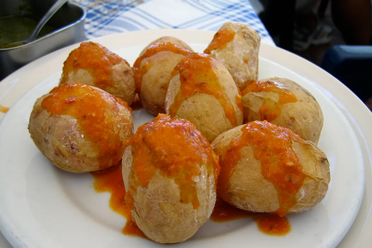
24. The guachinches. Unique to northern Tenerife, these tables opened in family homes at new-wine season serve home cooking — grilled meats, papas arrugadas with mojo rojo and verde, fresh cheeses — washed down with the estate’s own wine. It is the island’s most authentic experience, in the La Orotava valley or around Tacoronte, cradle of the Canaries’ first classified vineyards. Look for freshly painted signs on country roads, or ask your host — a guachinche listed in every guidebook is already not quite one any more. 25. The Santa Cruz carnival, reputed to be among the biggest in the world, turns the capital into a non-stop party around February–March: if your dates coincide, do not miss it — and book your accommodation very early.
Spread these pleasures across the week rather than stacking them: the app’s planner spreads your wishes over the week around the forecast — the volcano on the clear morning, the towns on the calima day, the sea when the wind drops.
A word from the locals
Tenerife punishes stationary holidays and rewards those who cross it. If you remember only three things: go up the volcano in the morning, never turn your back on the ocean on the north coast, and leave the resort at least every other day — the memories that last are hiding on the other side of the island.
And write down what you find, day after day: the app’s travel journal keeps your spots, notes and photos, from the first sunrise over the caldera to the last mojo.
The real Tenerife, in your pocket
The interactive explorer map: 196 spots checked on the ground, live weather zone by zone and timed road trips on the real roads. Free — no account, no bank card.
Discover Moris Insider →