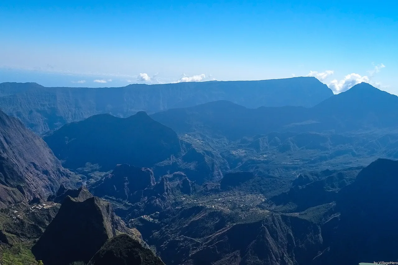
Réunion Island packs 2,512 km² with a 28 °C lagoon and a summit above 3,000 metres, two hours apart by road. One of the world's most active volcanoes, three cirques listed as UNESCO World Heritage, waterfalls dropping into deep forest, and Creole cooking worth the flight on its own. The classic first-trip mistake is trying to do everything and spending your days on mountain roads instead. Here are the 25 things we genuinely recommend, in the order you should tackle them — and every one of them sits on the 160 spots in the free app, with access details and today's weather.
Read the island before you drive it
Réunion works in three layers. The coast first: dry and sunny in the west, where the lagoon and most hotels are; wet and wild in the east, facing the trade winds. Then the Hauts, between 800 and 1,800 metres, where the Creole villages live, cane gives way to forest and evenings turn cool. Finally the summit: Piton des Neiges reaches 3,070 metres and remains the highest point in the whole Indian Ocean.
That verticality explains everything else, starting with the weather. It is perfectly normal to have 30 °C on l'Hermitage beach and under 10 °C at dawn on the volcano, on the same day. Clouds climb from the coast towards the interior in late morning, which is why every viewpoint — Maïdo, the volcano, Piton des Neiges — has to be done early. Very early. Our Réunion Island page sums up the regions and what you find in each; the general rule is simple: sleep in the west or the south, and climb in the morning.
The volcano: five essentials at Piton de la Fournaise
1. Pas de Bellecombe. This is the balcony that opens onto the Enclos Fouqué, the caldera the volcano pours its lava into. The view alone, at the end of the forest volcano road, justifies a 4 a.m. alarm. 2. Formica Léo, the perfectly shaped little red cone on the caldera floor, is a short walk away once you have gone down the Pas de Bellecombe staircase.
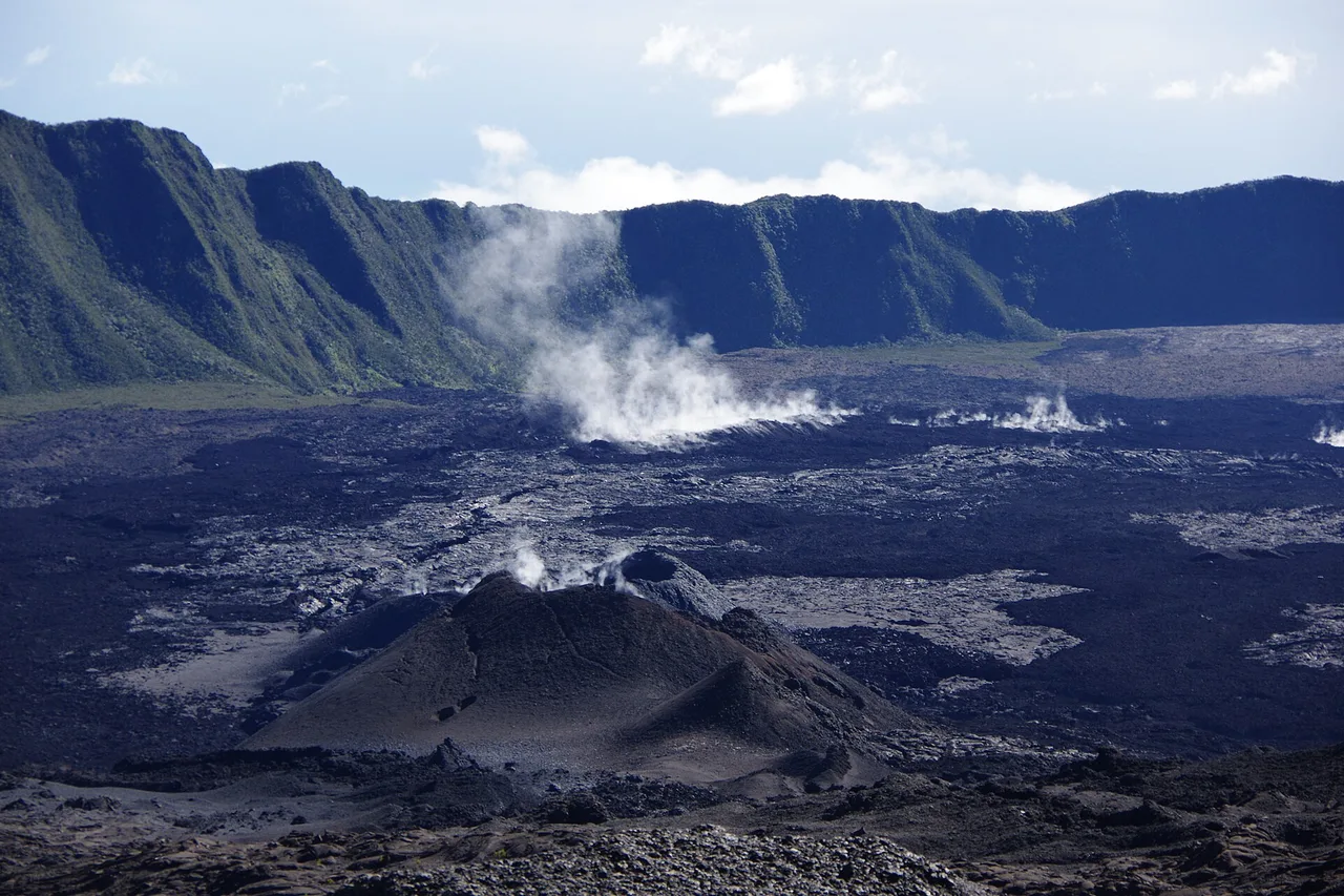
Access depends on volcanic activity, and that changes several times a year. After the eruptions of early 2026 the prefect moved back to the vigilance phase on 7 May 2026 and the trails reopened, but only partly: in the upper caldera only the Rivals trail to Caubet crater and the northern access to the Dolomieu viewpoint are authorised, the Kapor trail staying closed under the 2026 lava flow. Check the trail on the morning itself — today's conditions, zone by zone will save you a pointless drive, since mist usually closes the site by mid-morning.
3. The Plaine des Sables, crossed just before, is a desert of ochre and black scoria that looks borrowed from another planet: stop, walk ten minutes, the silence is total. 4. The lava road in the south-east runs along the Grand Brûlé where flows have buried the tarmac: you literally drive on cooled lava, all the way to the ocean. 5. The lava tubes can only be visited with a professional guide — these are galleries carved by moving lava, and supervision there is a necessity, not a formality.
The three cirques: Mafate, Cilaos, Salazie
They are the soul of the island, and the reason the national park's "pitons, cirques and remparts" are UNESCO World Heritage. 6. Mafate is the only cirque with no road: you get in on foot or by helicopter, full stop. Its hamlets — La Nouvelle, Marla, Roche-Plate, Îlet à Bourse — live to the rhythm of helicopter deliveries and walkers sleeping in mountain lodges. A night up there is the strongest experience the island offers.
7. Maïdo, at 2,205 metres, is the official balcony over Mafate: a thousand metres below, the hamlets look like lost villages. The trail down to Roche-Plate starts here too. Again: early morning, or the clouds swallow the cirque. 8. Cilaos has to be earned via the 400-bend road from Saint-Louis — a narrow road cut into the rampart, spectacular, and far longer than it looks on a map. You go for the village, its thermal baths, its lentils and its wine. 9. Îlet à Cordes, above Cilaos, offers absolute quiet and an end-of-the-world view.
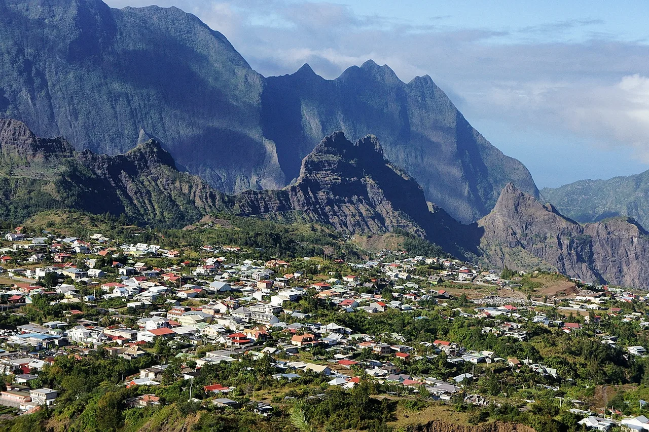
10. Salazie is the greenest and wettest of the three, and home to Hell-Bourg, listed among the most beautiful villages in France, with its fretwork Creole houses and gardens. 11. The Voile de la Mariée, on the road up, needs nothing more than a roadside stop: a waterfall in several overlapping veils down a rampart smothered in greenery. To fit all three cirques in without driving the same road three times, the explorer map draws your road trips timed on the real roads: it is the only honest way to know whether your day actually holds together.
Hikes, waterfalls and adrenaline
12. Piton des Neiges is the island's legendary climb: most people start from Cilaos, sleep at the Caverne Dufour lodge and walk up in the dark to reach the summit at sunrise, above a sea of clouds, with all three cirques at their feet. This is proper mountain hiking: serious ascent, cold at the top, head torch mandatory.
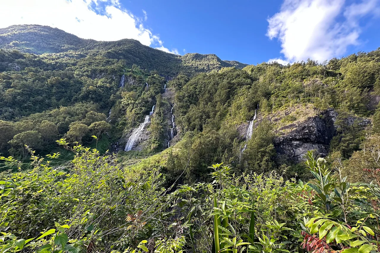
13. Trou de Fer, reached from the Bébour-Bélouve forest, is one of the most spectacular waterfall sites on the island — a chasm where several falls drop into the void. Many discover it by helicopter, but the viewpoint is earned on foot, often through mud and mist. 14. The eastern waterfalls, around Sainte-Suzanne and Saint-Benoît, are the most accessible: a few minutes' walk is enough. 15. Adrenaline, finally: Saint-Leu is a paragliding site famous well beyond the island, thanks to the thermal breeze rising along the rampart, and canyoning runs in the ravines of Cilaos and Salazie with professional guides.
A local rule: never plan two big items on the same day. A hike into a cirque is the whole day. For the rest, the app's planner spreads your wishes across the week using the forecast, which avoids the classic "volcano in the rain on the one day we had for it".
160 Réunion spots, checked on the ground
Volcano, cirques, waterfalls, lagoon, Creole tables: every spot with its page, its access and today's conditions. Free, no account.
Open the free map →The lagoon: where you can swim, and where you cannot
This is the one subject nobody jokes about in Réunion, and the one part of this guide to read in full. Swimming and board sports are governed by a prefectural order: they are allowed inside the lagoons and on the reef flats of the west coast, in developed areas protected by a net, and in monitored experimental zones watched by shark spotters, such as Boucan Canot or Roches Noires. Everywhere else it is prohibited — and enforced, with fines.
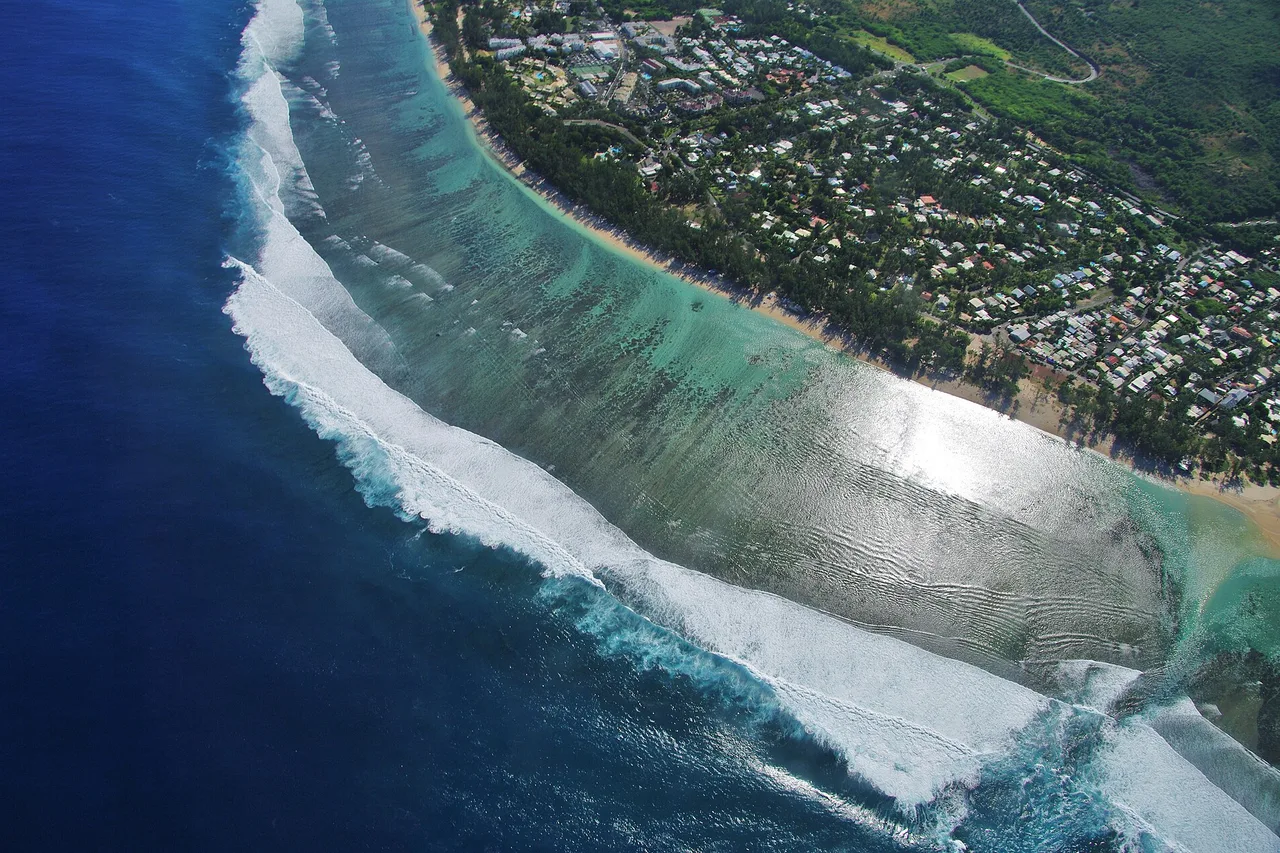
Within that framework there are still beautiful beaches. 16. L'Hermitage is the big family lagoon, lined with casuarina trees, with supervised zones and a pale sandy bottom. 17. La Saline-les-Bains, next door, is quieter and perfect late in the day. 18. Saint-Leu combines a narrow, fish-rich lagoon with Kélonia, the sea turtle observatory, which treats and releases injured animals — a visit that works as well for adults as for children. 19. Étang-Salé and its black volcanic sand are worth the detour if only for the contrast with the white coral sand next door. All these beaches, with their swimming zone and the day's sea state, are gathered in the Beaches category of the app.
The ocean: whales, dolphins and coral
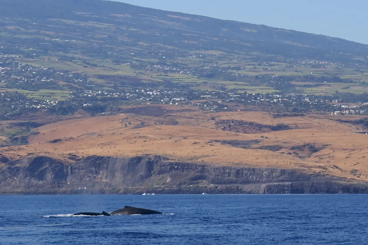
20. Humpback whales travel along Réunion from June to October, peaking in August and September. You can see them very well from land — the cap La Houssaye path, Pointe au Sel, the heights of Saint-Leu — and closer up by boat. The rules are strict, and rightly so: reduced speed from 300 metres, a maximum of five boats at that distance, observation capped at 45 minutes (15 minutes if other boats are waiting), and a quiet period from 6 p.m. to 9 a.m. when any approach is forbidden. The most committed operators also sign the Quiétude label charter, stricter still: that is your first selection criterion.
21. Dolphins — bottlenose and spinner — are on the west coast all year, often early in the morning. 22. Diving and snorkelling happen mainly between Saint-Gilles and Saint-Leu, where the reef shelters butterflyfish, moray eels and turtles. To know whether the water will be clear or churned on the day, the app's Ocean spots show swell, wind and visibility zone by zone.
Creole flavours and culture
23. The Saint-Paul seafront market is the island's meeting point: fruit, spices, vanilla, infused rums, crafts and street food, in an atmosphere that owes nothing to tourist staging. 24. Vanilla and the wild south go together: it is around Saint-Philippe and Sainte-Rose that you visit plantations, between lava cliffs and forest, with the Anse des Cascades — waterfalls dropping straight into a coconut grove facing the ocean. 25. Saint-Denis, finally, is walked rather than driven: rue de Paris and its Creole houses, the Jardin de l'État, the covered markets.
At the table, three dishes sum up the island: cari (chicken, fish or duck, served with rice, beans and rougail), rougail saucisse, and the samosas and chilli fritters you buy at the roadside. Infused rum closes the meal, Bourbon vanilla scents the desserts, and Bourbon pointu coffee — replanted on the island — turns up on a few good menus. Eat at least once at a table d'hôte or a Creole family restaurant: that is where the cooking is truest.
A word from the locals
Réunion punishes overloaded itineraries and rewards early risers. If you remember only three things: climb before the clouds do, swim only in authorised zones, and keep one day with nothing planned — it is almost always the one you remember, the day a local sends you down a trail no guidebook lists.
And write down what you find as the days go by: the app's travel journal keeps your spots, notes and photos, from the first cari to the last sunrise above the cirques.
The real Réunion, in your pocket
The interactive explorer map: 160 spots checked on the ground, live weather zone by zone and road trips timed on real roads. Free, no account, no card.
Discover Moris Insider →