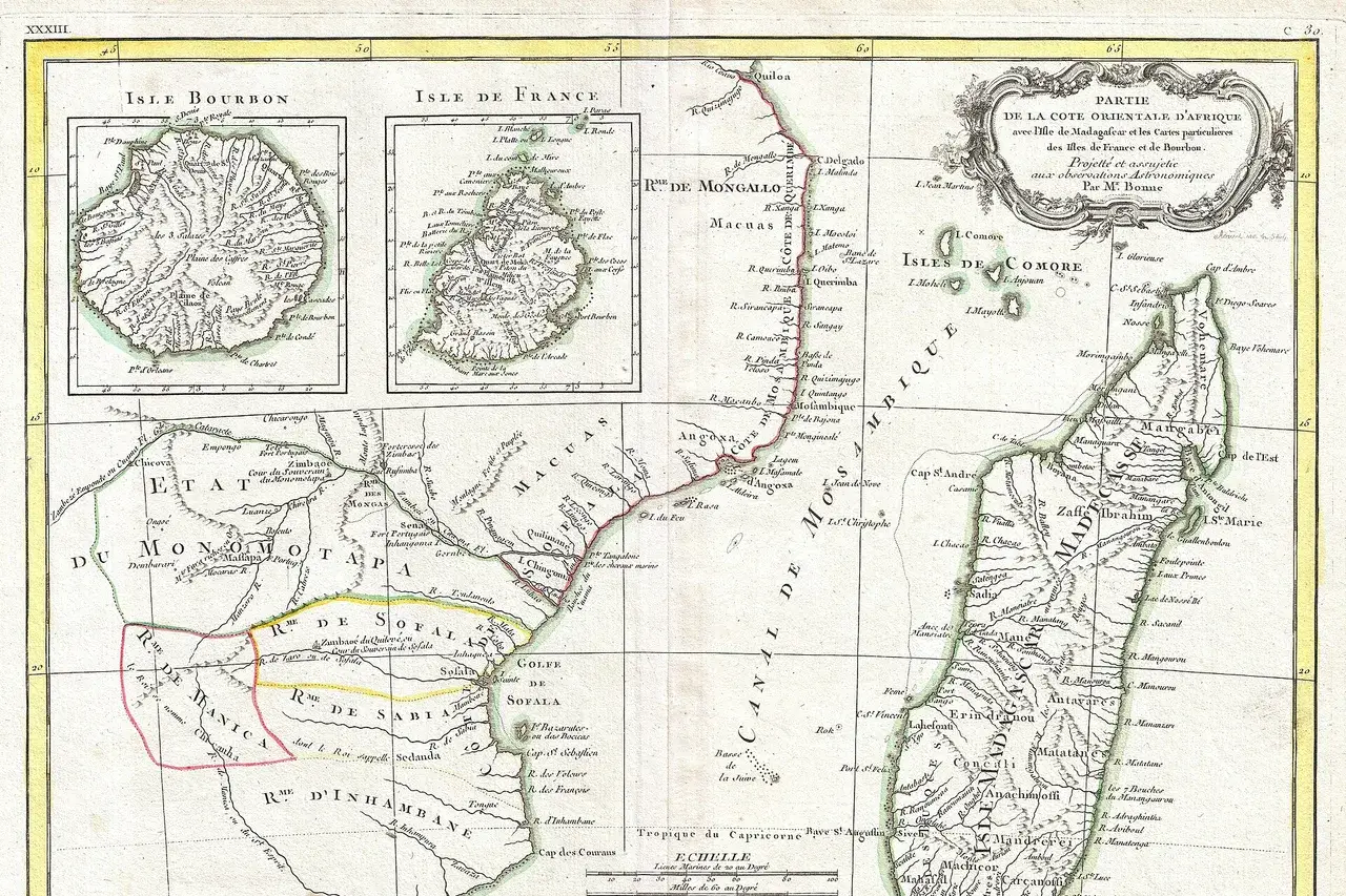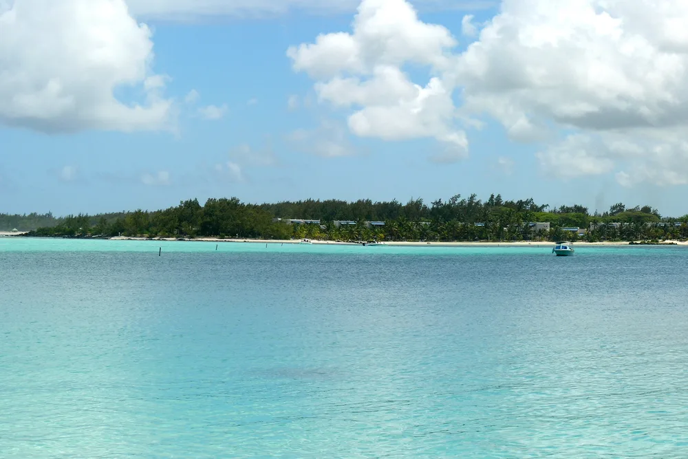
Blue Bay, 8 in the morning. The sea is flat, the water is clear, and nothing tells you that a few hundred metres away, beyond the reef, the water is moving fast. The current is the only part of the sea you cannot see from the beach. I live on the island and I built this app. Before a snorkelling or diving trip, I look at one tile, then one row of numbers: they tell me if the water is moving, and at what time it calms down. Here is what the app shows, screen by screen, with the real values of tonight.
The real problem: you cannot see the current
You can see the waves. You can feel the wind. The current leaves almost no mark on the surface. You notice it when you lift your head after ten minutes of finning and the beach is no longer where it was.
For a swimmer, it means tiredness. For a diver, it means a harder dive and often murkier water. And the current changes during the day, sometimes within a few hours. So you need to know it to the hour, for the place you are going.
What I did, screen by screen
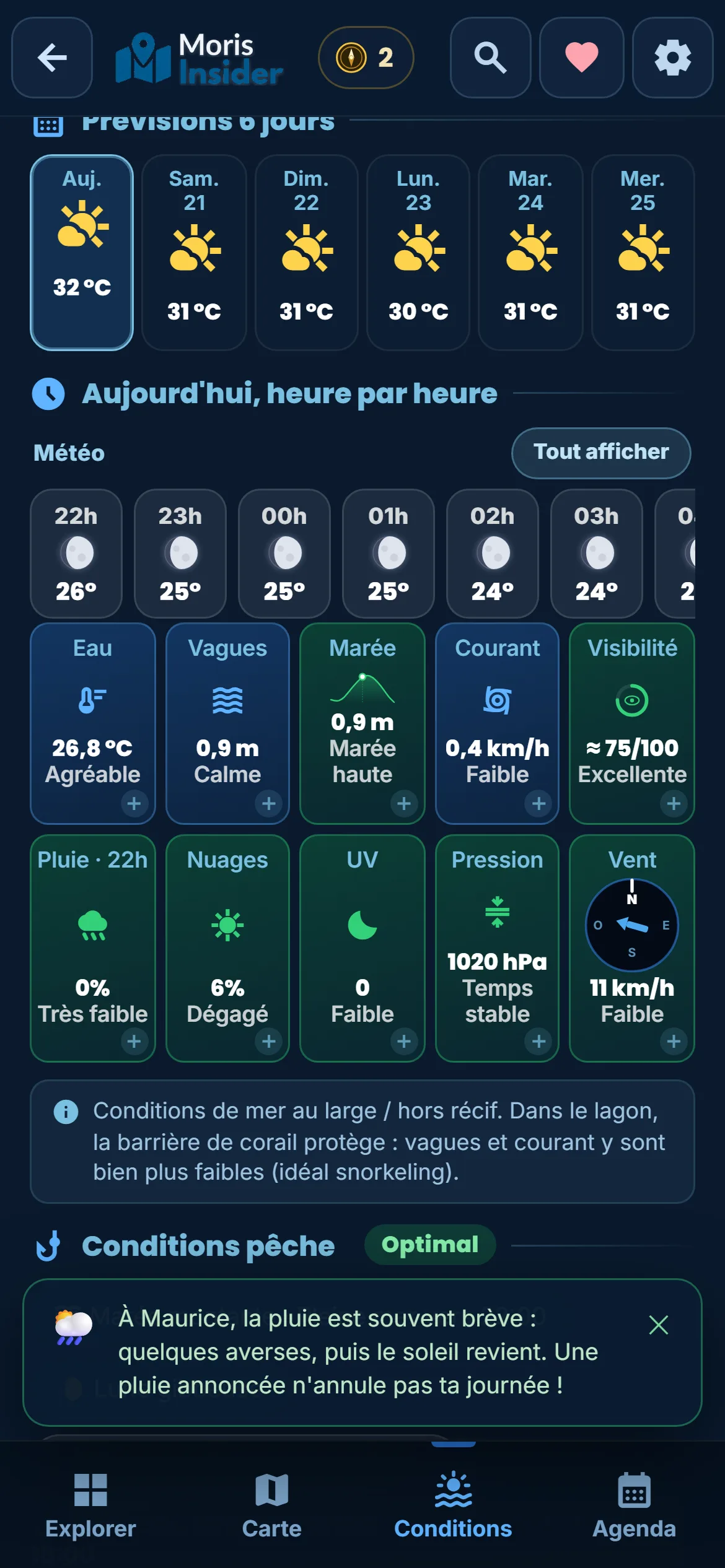
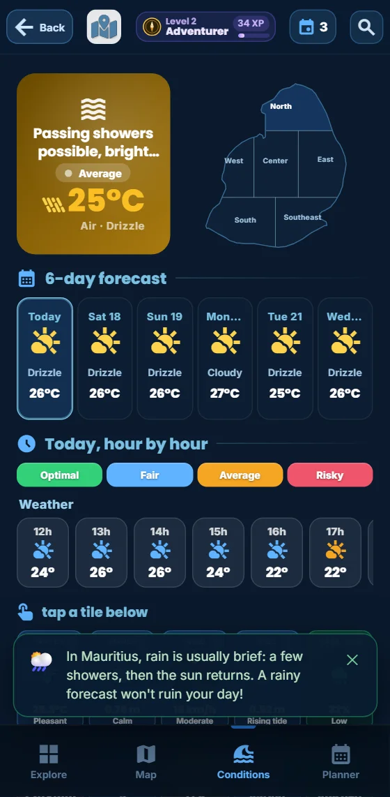
On Friday 20 November, around 9:30 pm, I opened the app to look at the night and the early morning. The screenshots come from the app itself, with the real values of the moment. The app was in French; in English the labels are translated.
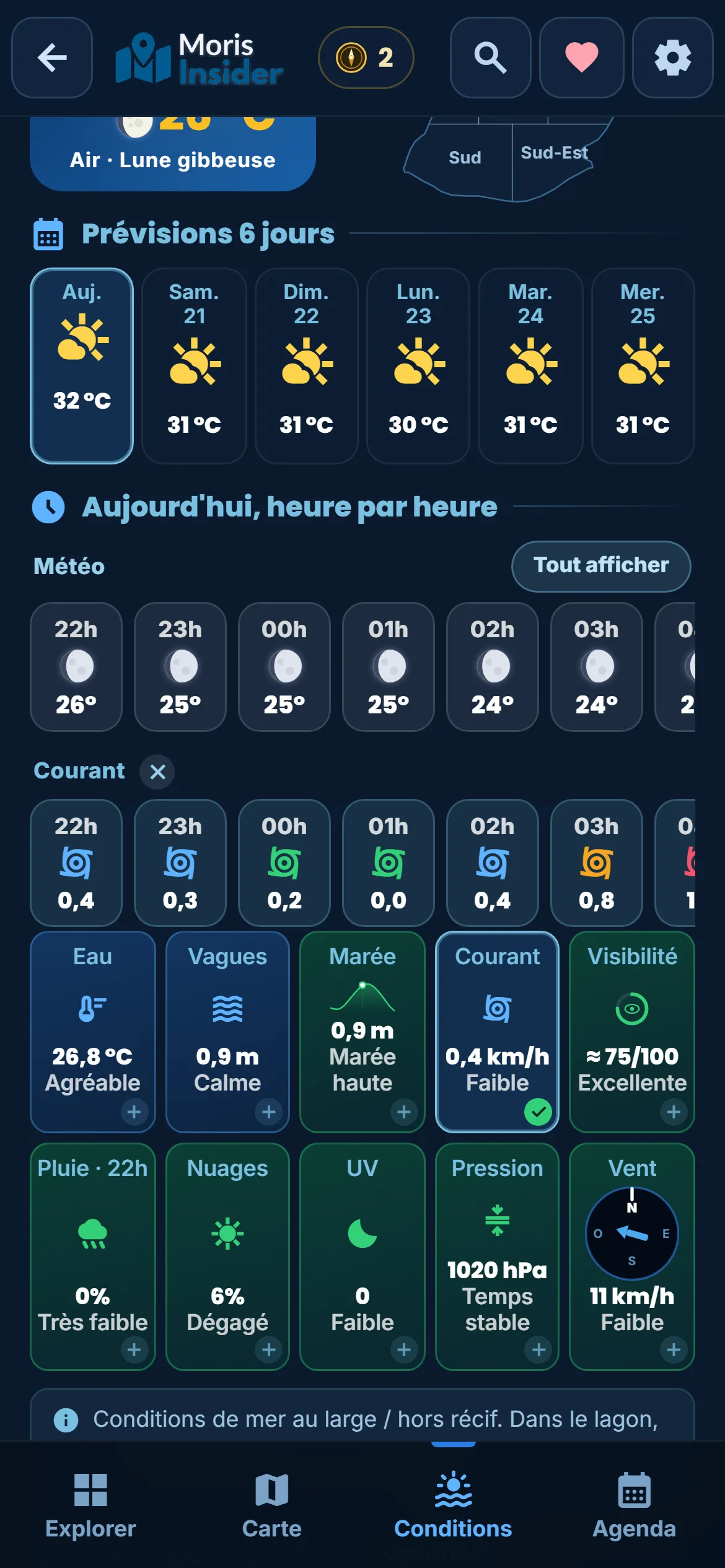
Read the tile. In the Conditions tab, I pick my region on the small map of the island. The first row of tiles is about the sea: water, waves, tide, current, visibility. The current has four levels: calm, weak, moderate, strong. Right next to it, underwater visibility takes it into account.
Tap the Current tile. One tap, and a “Current” row is added under the hourly weather. This is where it all happens: 0.4 km/h at 10 pm, almost nothing around 1 am, then 0.8 at 3 am and 1.2 km/h at 4 and 5 am, the “Strong” level. By 7 am it drops back to 0.6.
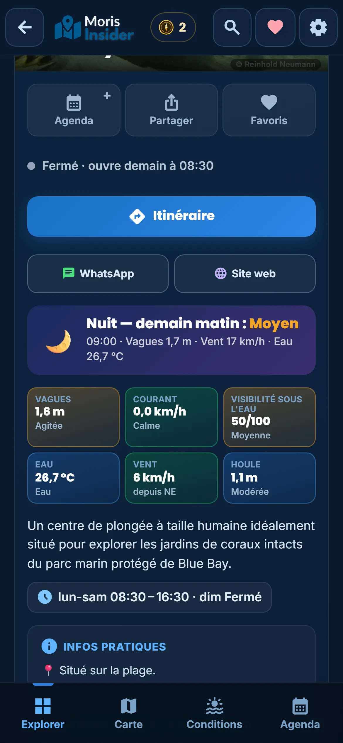
Open the place’s page. On a dive centre’s page, a “Current” box gives the value for its region, with its level. At Blue Bay Divers, in the south-east, that evening: 0.0 km/h, “Calm”. But the waves were at 1.6 m and visibility at 50 out of 100: the app never judges the current on its own.
What it is, what it allows, what it changes
What it is. The forecast current speed for each region of the island, in km/h, hour by hour for today, sorted into four levels: calm (under 0.3), weak (up to 0.7), moderate (up to 1.2) and strong (above). The figures come from Open-Meteo’s marine model.
What it allows. Seeing when the water moves and when it calms down. The current counts for one fifth of the verdict for a diving spot. And above 1 km/h, it lowers the underwater visibility score: the app links the two for you.
What it changes. You plan the outing for when the water is quiet, instead of fighting it. With the weekly planner, the day is built around that slot. You come back less tired, and you see more underwater.
What the app’s current does not do
It is the open sea, not your lagoon. The app says so itself under the tiles: these are conditions outside the reef. In the lagoon, the coral reef protects you, and the current is much weaker. On the other hand, a pass in the reef can pull much harder than the tile says.
The hour-by-hour detail is for today only. If you pick another day, the tile shows the value of the moment: it is not a forecast for that day. Check it the evening before or that same morning.
It gives the speed, not the direction. The app does not say where the water is heading. It does not replace the beach flags, the dive centre’s briefing or common sense: if the water carries you away, swim parallel to the beach.
For the rest, one tile and one row of numbers are enough. Check them before you leave, with the map of spots, and the water of Mauritius stays a pleasure.
One destination for life, a 3-day pass or an annual subscription