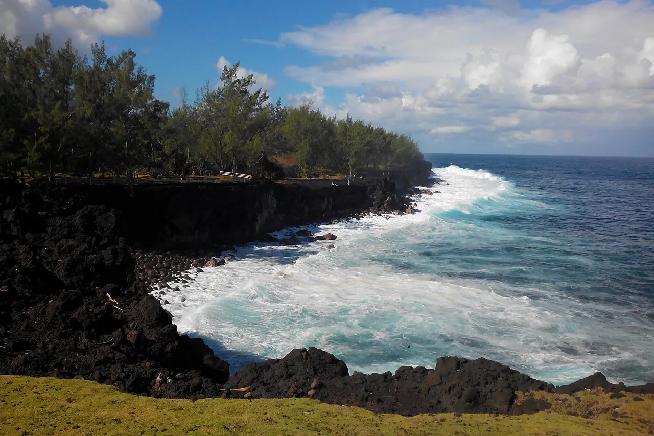
There is one coastline where Réunion Island has given nothing away: the Wild South. Between Saint-Joseph and Sainte-Rose, the road winds through lava fields, past black cliffs hammered by the ocean, and under forests where Bourbon vanilla ripens in the shade. No resort strip here, no landscaped seafront: just villages wedged between volcano and ocean, and landscapes that are literally redrawn by each eruption. Here is our complete guide — facts checked in September 2026.
Where exactly is the Wild South?
The name covers the island’s south-east coast, roughly from Grande Anse (Petite-Île) to Sainte-Rose, through Saint-Joseph and Saint-Philippe. This is the shore that lava flows from Piton de la Fournaise reach when they run all the way down to the ocean: some of the rock here is less than twenty years old, and the map has been redrawn several times within living memory.
The scenery is the exact opposite of the west-coast beaches: no coral lagoon, but basalt cliffs, black coves, screw pines bent by the trade winds and vegetation devouring everything the lava left behind. It is one of the most spectacular stretches of the island’s coastal loop — and one of the stops we rank without hesitation among the essential things to do on Réunion Island.
The lava road: crossing the Grand Brûlé
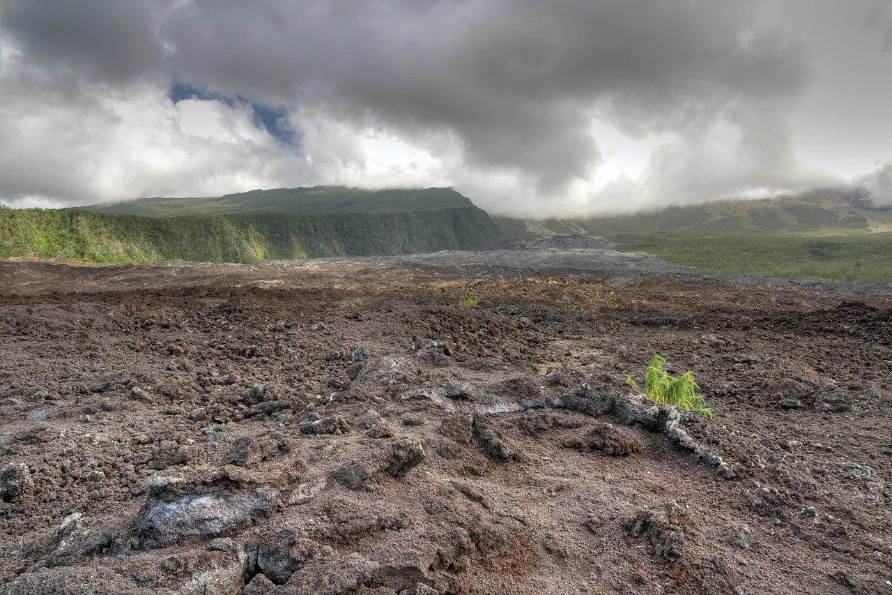
Between Saint-Philippe and Sainte-Rose, the RN2 road crosses the Grand Brûlé: the great slope down which flows from the volcano’s enclosure pour towards the sea. On either side of the road, lava fields follow one another, each signposted with the year of its eruption — an open-air geology book you leaf through from the driver’s seat.
The most impressive page is April 2007, the “eruption of the century”: from 2 April to 1 May, the volcano emitted around 120 million cubic metres of lava. The flow reached the ocean within hours, cutting the RN2 on the very first afternoon, and built a platform of about thirty hectares out into the sea; north of the Pointe du Tremblet, a brand-new beach appeared at the foot of the cliff — the youngest in France. The rebuilt road now runs across the flow: stop only at the designated viewpoints, as the young rock is razor-sharp and unstable off the marked areas.
Notre-Dame-des-Laves and the memory of eruptions
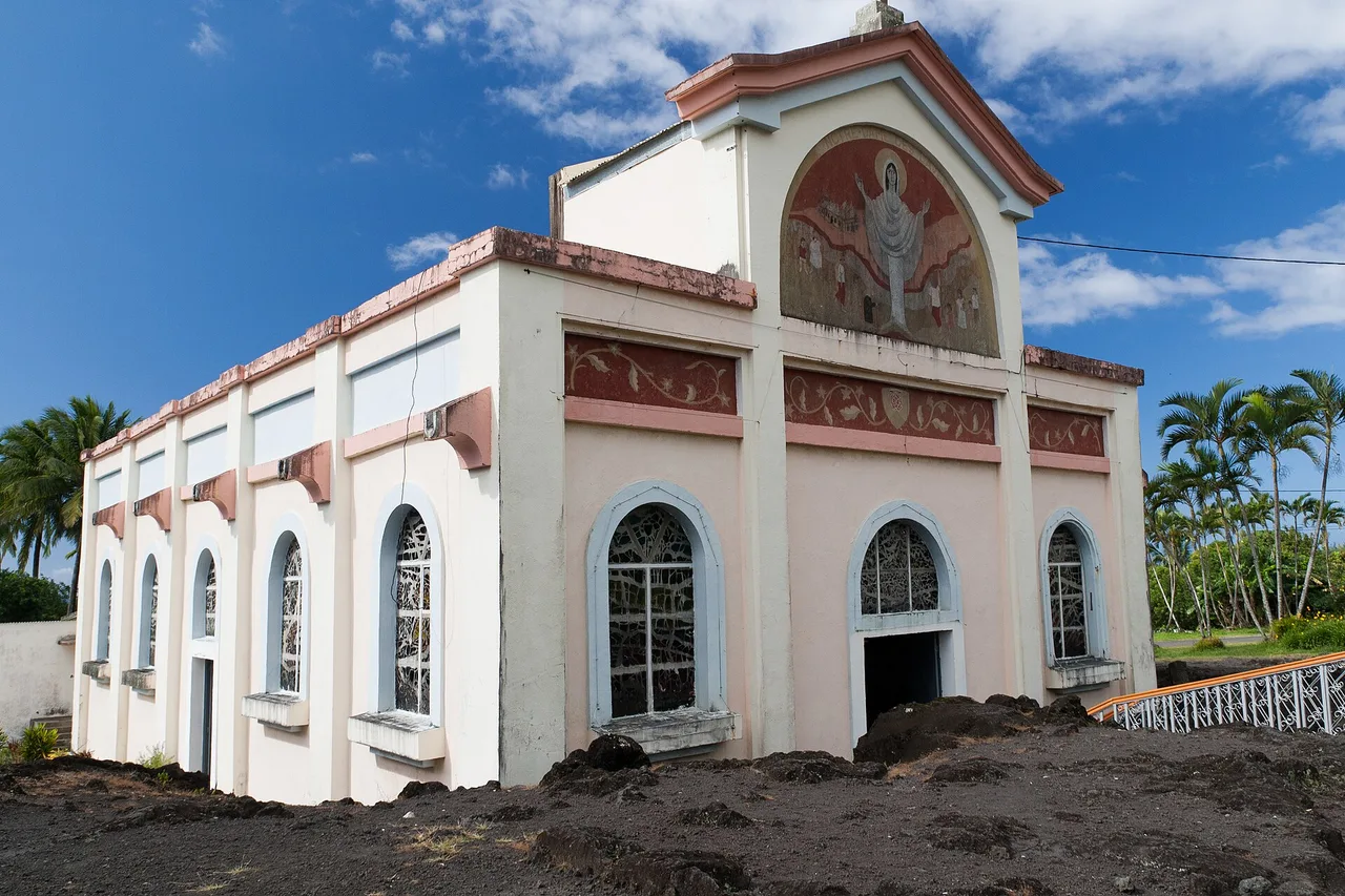
In Piton Sainte-Rose, at the northern end of the lava road, a church tells the most astonishing story in Réunion’s volcanic history. In April 1977, an eruption outside the enclosure overran the village: dozens of houses were destroyed and about 1,500 people evacuated. The flow reached the church, pushed roughly three metres into the nave… and stopped. Restored in 1985, the building became Notre-Dame-des-Laves: the frozen black lava still sits against the forecourt — a stop that takes only a few minutes and stays with you.
Another date carved into this coast: March 1986. Lava again broke out of the enclosure, burned eight houses near Le Tremblet and poured into the sea at Pointe de la Table, enlarging the island by some 25 to 30 hectares. A footpath now crosses that mineral headland, facing the open ocean. A few kilometres further north, Anse des Cascades lines up its palm grove and its ribbons of water sliding off the cliff — damaged by cyclone Fakir, the site reopened in 2018.
Cliffs, blowholes and rock pools: where to touch the ocean
The Wild South shoreline is more for watching than for swimming — and you will watch it for a long time. At Cap Méchant (“Wicked Cape”), in Saint-Philippe, the ocean slams into black basalt cliffs fringed with screw pines: spray, plumes of foam, a continuous rumble — the name is well earned, the sea here is genuinely dangerous, so stay on the plateau. Further west, the puits arabe, a mysterious stone-lined well by the water, sits beside one of the island’s loveliest picnic grounds.
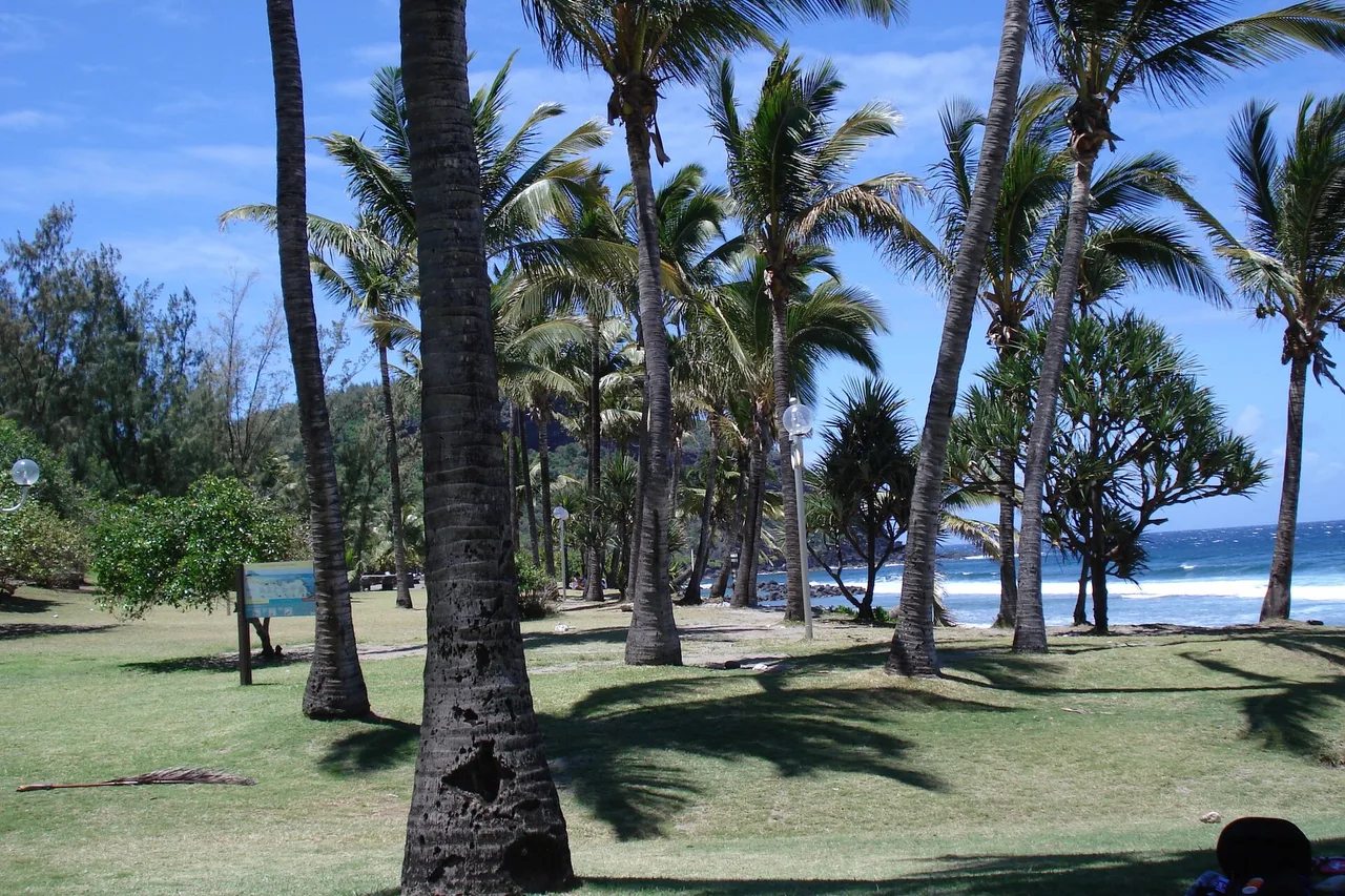
For an actual swim, two supervised spots. Manapany-les-Bains, in Saint-Joseph: a pool built into the basalt, where you paddle while waves explode on the rock barrier. And Grande Anse, the postcard of the South with its coconut grove — swimming only in the marked pool, watched over by a lifeguard station. A reminder that applies island-wide: since the 2017 prefectoral order, ocean swimming is forbidden outside the lagoon and supervised zones — our guide to Réunion’s beaches and lagoons covers the rules and the good spots.
Bourbon vanilla, grown under the trees
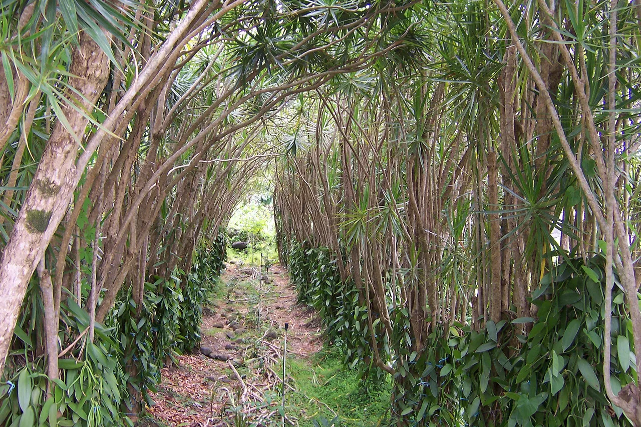
The Wild South is the cradle of Bourbon vanilla — named after the island’s former name. It was here, in 1841, that a twelve-year-old enslaved boy, Edmond Albius, worked out the hand-pollination technique still used across the world today. In Saint-Philippe the vines grow “sous bois” — under the forest canopy, clinging to tree trunks: a discreet, entirely manual crop that yields one of the most sought-after vanillas in the world.
Three visits to understand it. Escale Bleue, at Le Tremblet, a family workshop founded in 1986: guided tours Monday to Friday at 1:30, 2:30 and 3:30 pm — allow 30 to 45 minutes, €5 per adult, €3 per child. Vanille 100 % Réunion, at grower Harry Leichnig’s farm in Saint-Philippe, shows the full cycle from flower to cured pod. And the Jardin des Parfums et des Épices at Mare Longue is open daily from 9 am to 5 pm (entry €7; guided tours at 10:30 am and 2:30 pm by reservation, about 1½ hours, €10 adult, €6.50 child) — all set within the Mare Longue forest, one of the island’s last remaining lowland primary forests.
One day in the Wild South (and where to eat)
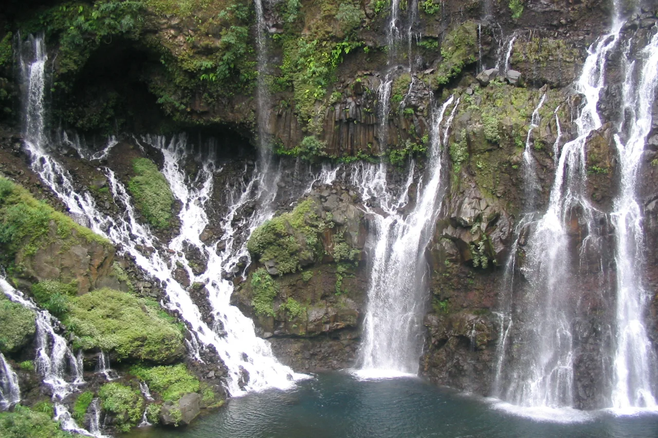
The itinerary that works: leave Saint-Pierre early, first swim stop at Manapany or Grande Anse, then work your way up the coast — Cap Méchant, the puits arabe, the Mare Longue forest and a vanilla visit in the early afternoon (Escale Bleue’s time slots fit exactly), the crossing of the Grand Brûlé, a pause at Notre-Dame-des-Laves, and the same coast road back in the late-day light. Count on a full day; with a night in Saint-Philippe or Saint-Joseph you can add the Langevin valley and its Grand Galet waterfall, one of the island’s finest — swimming in the lower pools only, never under the fall itself, as we explain in our guide to Réunion’s waterfalls.
At the table, the Wild South has a speciality you will hardly find anywhere else: salade de palmiste, fresh heart of palm, served in the little Creole restaurants of Saint-Philippe and Le Baril — often before a generous cari. The snack bars at Cap Méchant have made it their signature. To slot this stage into a full circuit, our 10-day Réunion Island itinerary gives it a whole day.
Practical tips: weather, road, budget
The Wild South belongs to the windward side of the island: it rains distinctly more than in the west — the east coast receives 3,000 to 5,000 mm of rain a year, while Saint-Gilles stays under 700 mm. The fix is simple: start early — morning light is at its best on the cliffs, and showers tend to build through the day. And a clearing right after rain, with glistening black rock and flying spray, beats any blue-sky postcard.
Practicalities: the RN2 is a fine road but winding between Saint-Joseph and Saint-Philippe — allow more time than the map suggests, and fill up before you set off (unleaded petrol costs €1.83/L under the prefectoral order of 1 September 2026, and stations thin out past Saint-Joseph). During eruptions, short closures can affect the lava road: check on the morning itself. Finally, respect closed trails and no-swimming signs — in this part of the island more than anywhere, they are not decoration. For the rest of the numbers, our Réunion Island trip cost article gives real prices line by line.