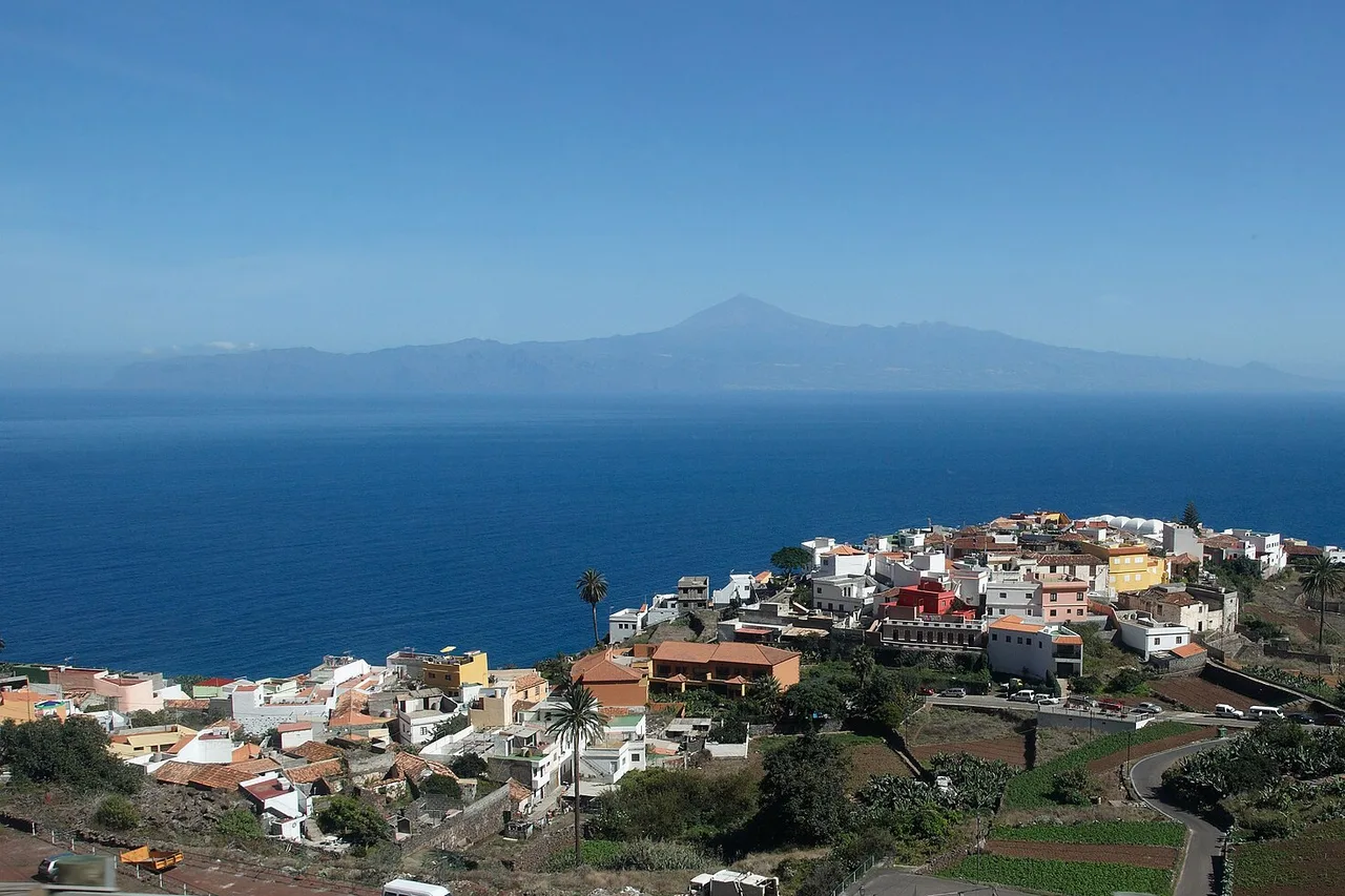
Twenty minutes from Santa Cruz, another world begins. The Anaga massif, Tenerife's north-eastern tip, piles up jagged ridges, valleys that plunge straight into the Atlantic, hamlets clinging to cliff faces — and a laurel forest born long before the Ice Ages, which you cross in the mist of the trade winds. UNESCO made it a Biosphere Reserve in 2015, and the massif claims one of the highest concentrations of endemic species in Europe. It is the exact counterpoint to the beach-resort south: no seafront promenades here — just trails, viewpoints and villages where time has a different texture. Here is how to do it properly, Enchanted Forest permit included.
A forest from before the Ice Ages
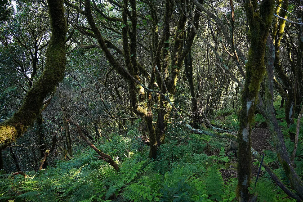
Anaga's laurisilva is a relic: this humid subtropical forest covered the Mediterranean basin millions of years ago, before the glaciations wiped it off the continent. It survived only on the islands of Macaronesia — the Canaries, Madeira, the Azores. Canary laurels, tree heather the size of real trees, trunks gloved in moss, lichens hanging like beards: the atmosphere is pure fairy tale, especially when the mist rolls in — which is often. The mechanism is simple and beautiful: the ridges catch the clouds pushed by the trade winds, and the forest drinks that moisture all year round. In practical terms, for the hiker, that means frequent mist, possible drizzle and slippery trails, even while Costa Adeje roasts in the sun; our guide to the best time to visit Tenerife explains this island of several simultaneous climates.
Cruz del Carmen, the gateway
Everything starts at Cruz del Carmen, fifteen minutes from La Laguna on the ridge road: a park visitor centre, a viewpoint overlooking the valley all the way to Mount Teide on clear days, and the start of the Path of the Senses (Sendero de los Sentidos), a short, family-friendly loop through the laurel forest, partly accessible, dotted with stations about the forest's sounds, textures and smells. You take the measure of the place in an hour, trail maps in hand — the visitor centre gives the real state of the paths, which is worth gold after rain. Good news for travellers without a car: Titsa bus line 273 climbs here from La Laguna's interchange. From Cruz del Carmen the massif's great routes fan out, including the PR-TF 10 down to the ocean.
The Enchanted Forest: the trail you have to earn
The most coveted trail in Anaga is officially called El Pijaral, and everyone knows it as the Bosque Encantado — the Enchanted Forest. It is a strict nature reserve, and visiting comes with conditions: a free, named permit, a quota of 45 people per day, booked on the Cabildo's platform (centralreservas.tenerife.es or the Tenerife ON app, one application covering up to 5 people). Slots open every Monday at 7 am, Canary time, for dates 14 to 56 days ahead — the same ritual as for the summit of Mount Teide, and weekend places go fast. The digital permit on your phone is enough, with ID matching the booking; hiking without authorisation costs a €600 fine, and checks do happen. The reward: the laurisilva at its densest — twisted roots, fog between the trunks, and sudden windows onto the Anaga sea stacks. If the slots are gone, take comfort: the rest of the massif is free to walk, and it is superb.
PR-TF 10: from the ridge to the ocean via Chinamada
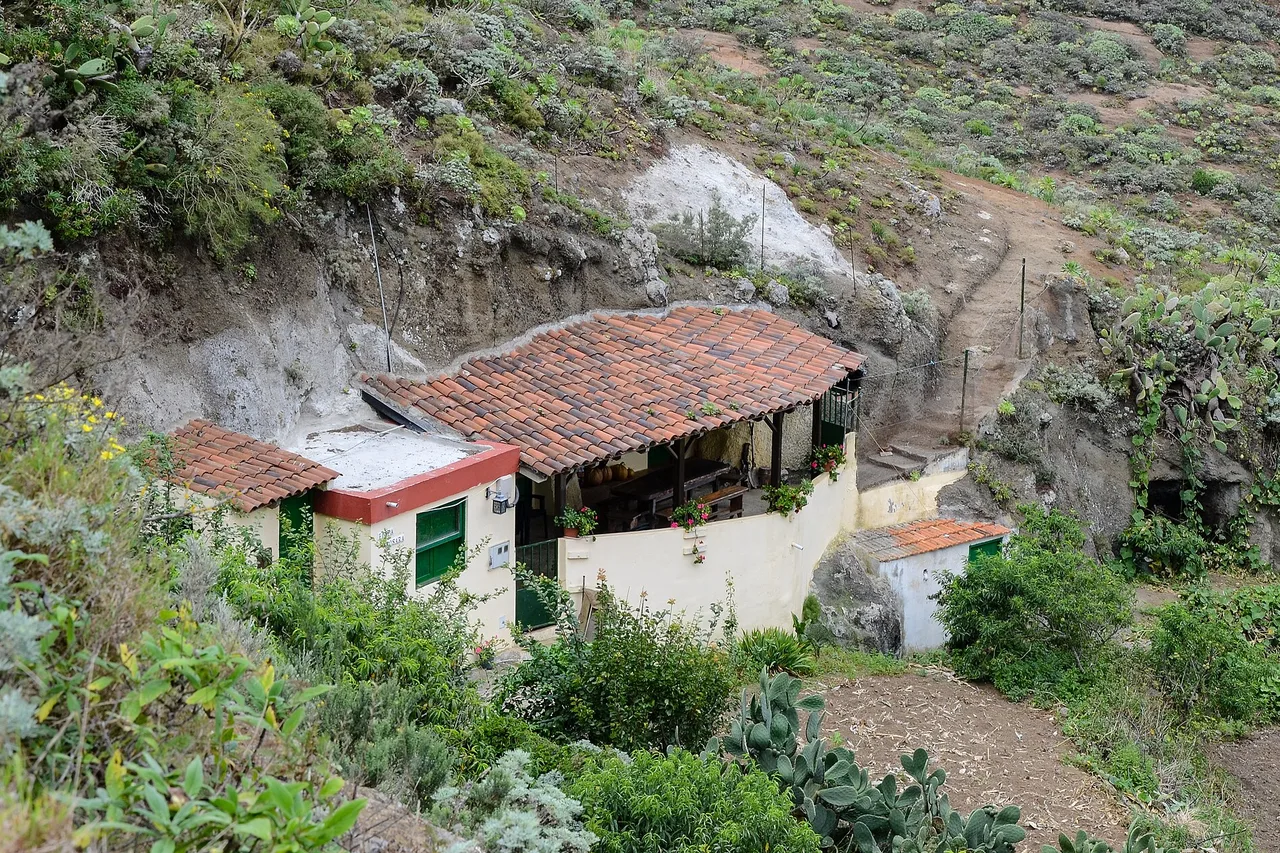
If you only do one hike, make it this one. The PR-TF 10 leaves Cruz del Carmen and walks down every level of the massif to the ocean. Laurel forest first, then terraced fields, and finally Chinamada, a hamlet set on a shelf at about 600 metres: some thirty cave houses dug into the volcanic tuff, still inhabited — whitewashed façades out front, cool rock-cut rooms behind. The final stretch is the most spectacular: a path carved into the cliff, tumbling down towards Punta del Hidalgo with the north coast below you the whole way. Allow a good half-day, preferably downhill; at the bottom, lines 050 and 105 run back towards La Laguna and Santa Cruz — one of the island's rare big hikes that closes neatly by public transport.
Taganana and Benijo: the slope that falls into the Atlantic
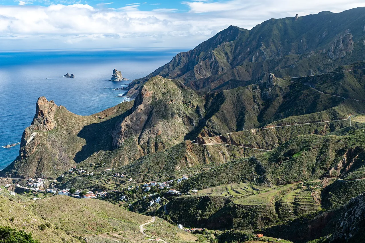
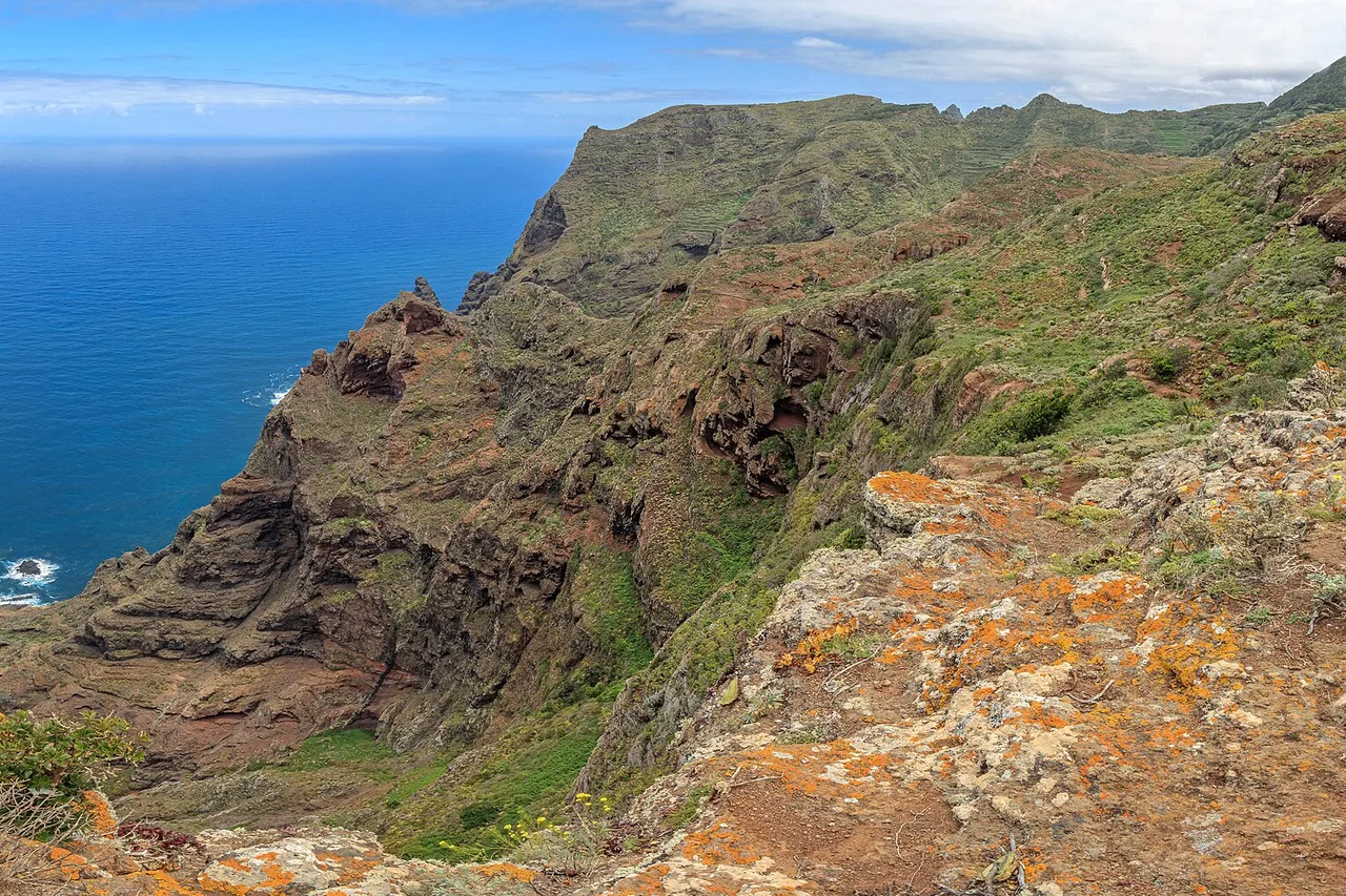
On the far side of the ridge, the road tips over at El Bailadero and hairpins down to Taganana, the great historic village of the northern slope, surrounded by terraced vineyards that produce whites and reds with real character. Below, the shoreline strings together Roque de las Bodegas and Almáciga, black-sand beaches loved by surfers, with grilled-fish terraces facing the waves — the ocean here is powerful and mostly unsupervised: swim close to shore, never alone. At the end of the road, the viewpoint above Benijo serves one of the wildest landscapes in the Canaries, Anaga's black sea stacks planted in the Atlantic. But know this before heading down the steps: Benijo beach itself is closed — it has been for around two years due to rockfall risk, and the safety works were still stalled in summer 2026. Admire from above, full stop. Our guide to Tenerife's beaches covers this coastline and its precautions. Without a car, line 946 links Santa Cruz to Taganana and Almáciga via San Andrés.
Taborno and Chamorga: hamlets at the end of the world
Anaga's third face is its ridge hamlets, served by roads that never stop turning. Taborno, a handful of houses on a spur, faces the Roque de Taborno, a pinnacle so cleanly cut that hikers have nicknamed it the "Matterhorn of Tenerife"; an easy loop walks around it, dizzying panoramas guaranteed. At the far end of the massif, Chamorga is the last village before the Anaga lighthouse — the literal end of the road, where line 947 climbs from Santa Cruz via El Bailadero. Between the two, the ridge road strings out its viewpoints: Pico del Inglés above the sea of clouds, Jardina facing La Laguna's plain. None of these names is a brochure "must-see", and that is precisely their value: this is rural Canarian life as it continues — terraced vegetable gardens and dogs asleep in the middle of the road. Drive slowly and park only in the marked spots — these hamlets were not drawn for our cars.
Full guide: Renting a Car in Tenerife: Pitfalls and Smart Tips
Planning your day (or your two days)
In one day: Cruz del Carmen and the Path of the Senses in the morning, a picnic at the ridge viewpoints, Taganana and the Benijo viewpoint in the afternoon — the classic loop, magnificent and unhurried. In two days: add the PR-TF 10 down to Punta del Hidalgo, and the Enchanted Forest if you caught a permit on a Monday morning. Three local reflexes to finish. One: start early — the light is better, the roads empty, and the mist often kinder before noon. Two: read the sky by slope, not for the island as a whole; if the ridge is socked in, the Taganana coast may be in sunshine, and vice versa. Three: real shoes, a warm layer and water — Anaga's mountains are low in altitude but demanding, and help is far away. Anaga pairs naturally with La Laguna, the former capital and a UNESCO World Heritage Site, fifteen minutes from Cruz del Carmen: day 7 of our one-week Tenerife itinerary marries them exactly that way, and our guide to things to do in Tenerife puts the massif back among the island's essentials.