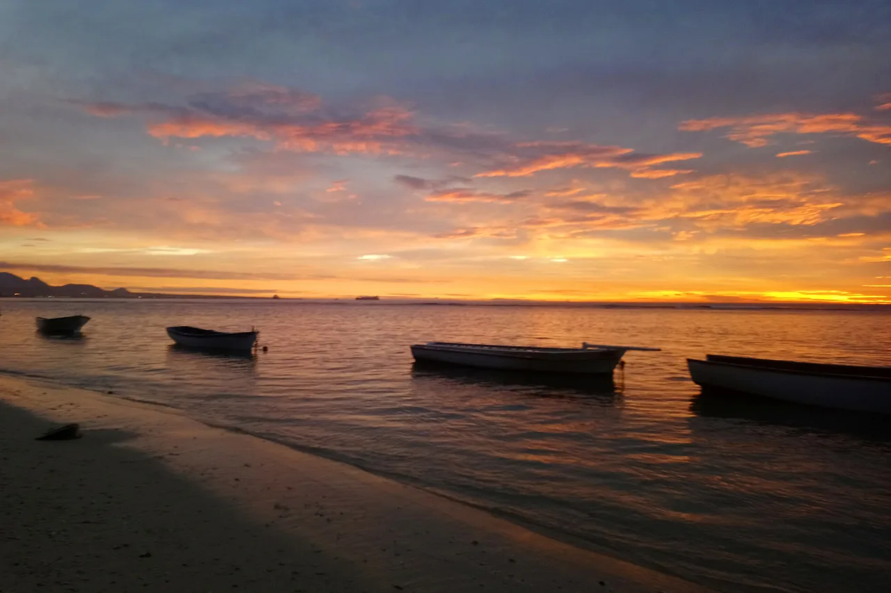
Ten past five, the coast road still empty, and the real question of the morning: is it worth heading out now, or should I have been up an hour earlier? In Mauritius the answer is not down to luck — it comes down to the tide, the moon, the barometer and the light. For a long time I cross-checked those four things by hand, across three tabs and a paper almanac. That cross-check is exactly what the fishing mode in the app now does, on a single screen.
Budget tip: in Mauritius, part of your activities can cost you less. See how to save money with discounts on your activities.
I live in Mauritius and I built Moris Insider, the island’s guide and map. This article covers one single feature: fishing mode — what it actually calculates, what it puts on screen, and what it cannot do.
The five o’clock question
Going fishing in Mauritius is not a matter of luck, and everyone here who makes a living from the sea will put it the same way: there are hours when the water works, and hours when it sleeps. The difficulty is not knowing that. It is knowing it this morning, for your stretch of coast, without spending twenty minutes reconciling three sources that do not speak the same language.
The information exists, but it is scattered. Tide tables live on one site, in high and low water times, saying nothing about when the current actually turns. The moon phase sits on a calendar, unconnected to the hour you plan to fish. Atmospheric pressure is in a weather app, as an instant reading — when what matters is not the number but the direction it is moving in. And nobody ever mentions light, even though it carries the heaviest weight of all.
The outcome is always the same: you end up going out at whatever hour suits the rest of the day, and hope for the best. After several seasons of doing exactly that, I decided to code the cross-check once and for all, inside the tool I was already using to decide where to go on the island.
What I actually check before leaving
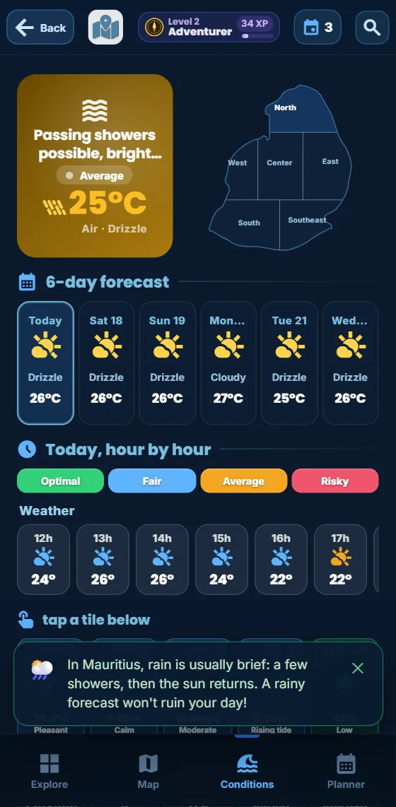
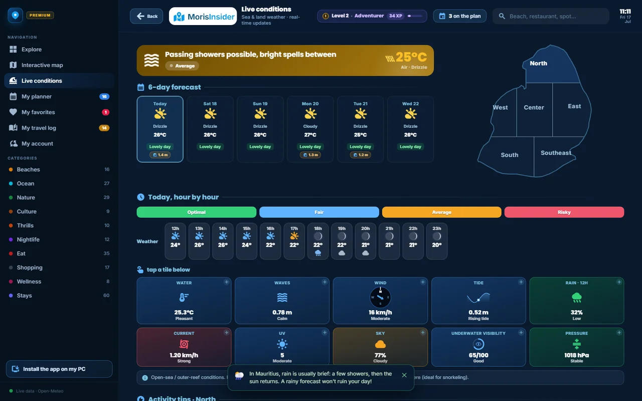
It takes fifteen seconds, usually with a coffee in hand. I open the app, Conditions tab, and pick my region at the top of the screen — the east and west coasts do not run the same tide at the same time, which is precisely what makes a generic almanac useless here.
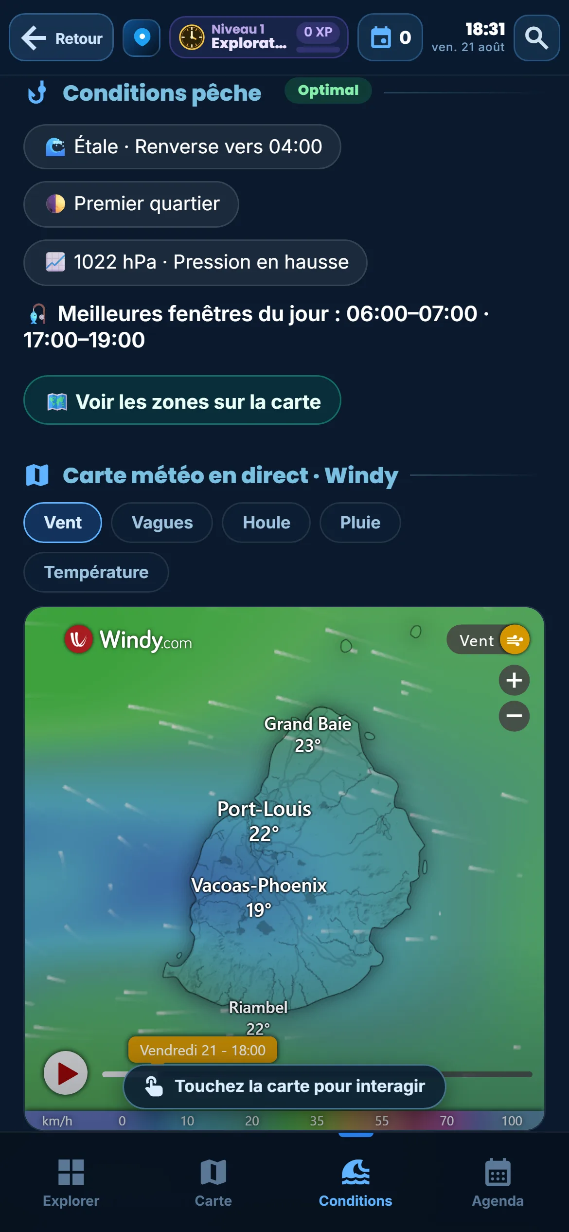
Below the activity recommendations, a block headed "Fishing conditions" opens up. It comes down to three chips, and I read them in this order:
- The tide — "Rising tide", "Falling tide" or "Slack water", followed by the time of the next turn. This is the line I look at first, because it decides what time to leave.
- The moon — its phase, with its symbol, and the note "Strong solunar period" when we are on a new or full moon.
- The pressure — the reading in hectopascals and, above all, its trend: falling, steady or rising.
Three chips, a second each. If slack water is an hour away and the barometer is dropping, I take the rods. If the tide has been falling for three hours and pressure is climbing back, I do something else and put the outing in tomorrow’s "My week" planner.
Four signals, one score out of a hundred
The feature itself, plainly: the app does not simply display four readings side by side, it weights them. Each signal gets a score, and the four are blended by fixed weights into a conditions score out of a hundred. Here is the exact split, as it runs in the app:
- Light: thirty per cent. The heaviest weight, level with the tide. The seventy-five minutes around sunrise, and the seventy-five around sunset, score the maximum. The rest of the day sits well below.
- Tide: thirty per cent. Slack water — the moment the water has stopped rising and has not yet begun to fall — scores highest. A rising tide follows closely. A falling tide is the lowest of the three.
- Moon: twenty per cent. New moon and full moon take the maximum: these are the strong solunar periods, the ones with the biggest tidal range. Both quarters sit at the bottom, and the phases in between fall in the middle.
- Pressure: twenty per cent. It is not the reading that is scored, it is the change over the past three hours. A fall of at least one and a half hectopascals is the best case; a rise of the same size, the worst; between the two, steady pressure earns a middling score.
The advantage comes down to one word: comparison. Four raw readings do not compare with each other — "1013 hPa" and "rising tide" do not land on the same scale in your head, least of all at five in the morning. A single score does. The benefit shows up in sleep and in fuel: you stop going out "just to see". You go when the score is high and stay in bed when it is not — which, over a week of holiday where every morning counts, completely changes how you build the plan.
Check today’s conditions
Tide, moon and pressure for your region appear in the app. No card needed.
Discover the app →Six spots, and a map that reshuffles them
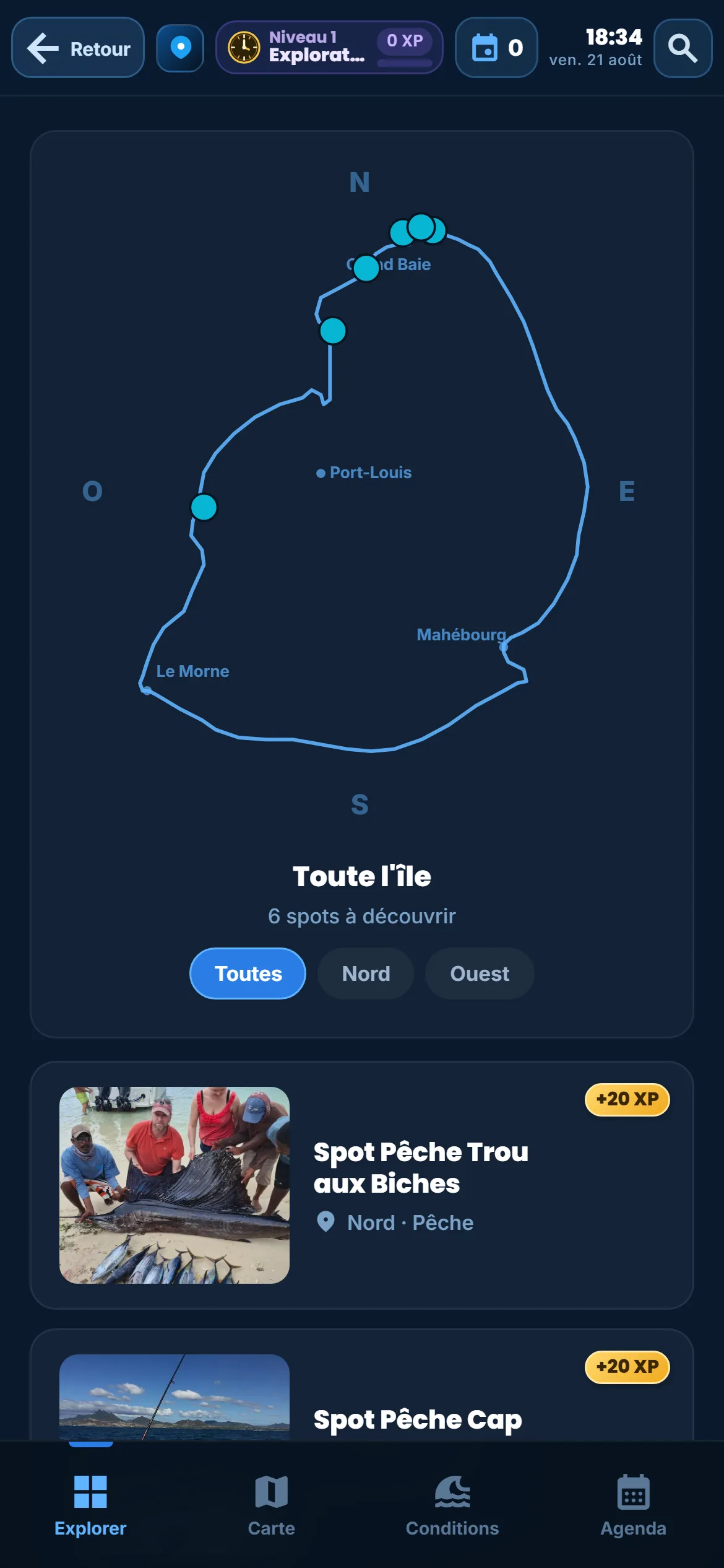
Knowing when is not enough: you also need to know where. The app lists six places in the Fishing sub-category, on top of the boat trips and big-game outings filed under excursions. On each of those six pages, the same "Fishing conditions" block repeats, calculated for that spot’s zone rather than an island-wide average.
There is a detail here that matters, and that I would not have guessed as a plain user: for these spots, the score shown is not the one other places get. A beach or a hike is scored on general conditions — wind, swell, rain, temperature. A fishing spot gets a blended score instead: a little over half comes from general conditions, a little under half from the fishing score of its zone. The direct consequence: the ranking moves through the day. The same place does not come out at the same rank at dawn slack water and at two in the afternoon.
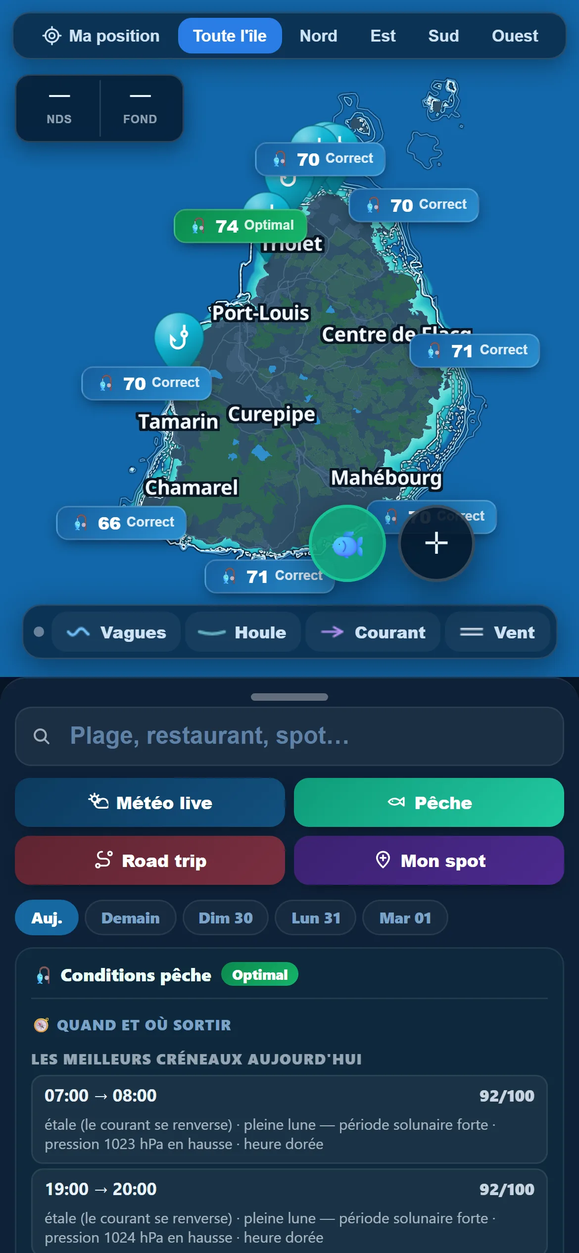
From the "Fishing conditions" block, a "See the zones on the map" link opens the island map in fishing mode directly. This is not the ordinary map: the zones are coloured by their fishing score for the moment, which shows at a glance which side of the island the water is working best on right now.
The places you set aside as you scout stay filed in your favourites: in the morning you open your list instead of running the search again.
The windows of the day, and why they sit behind a padlock
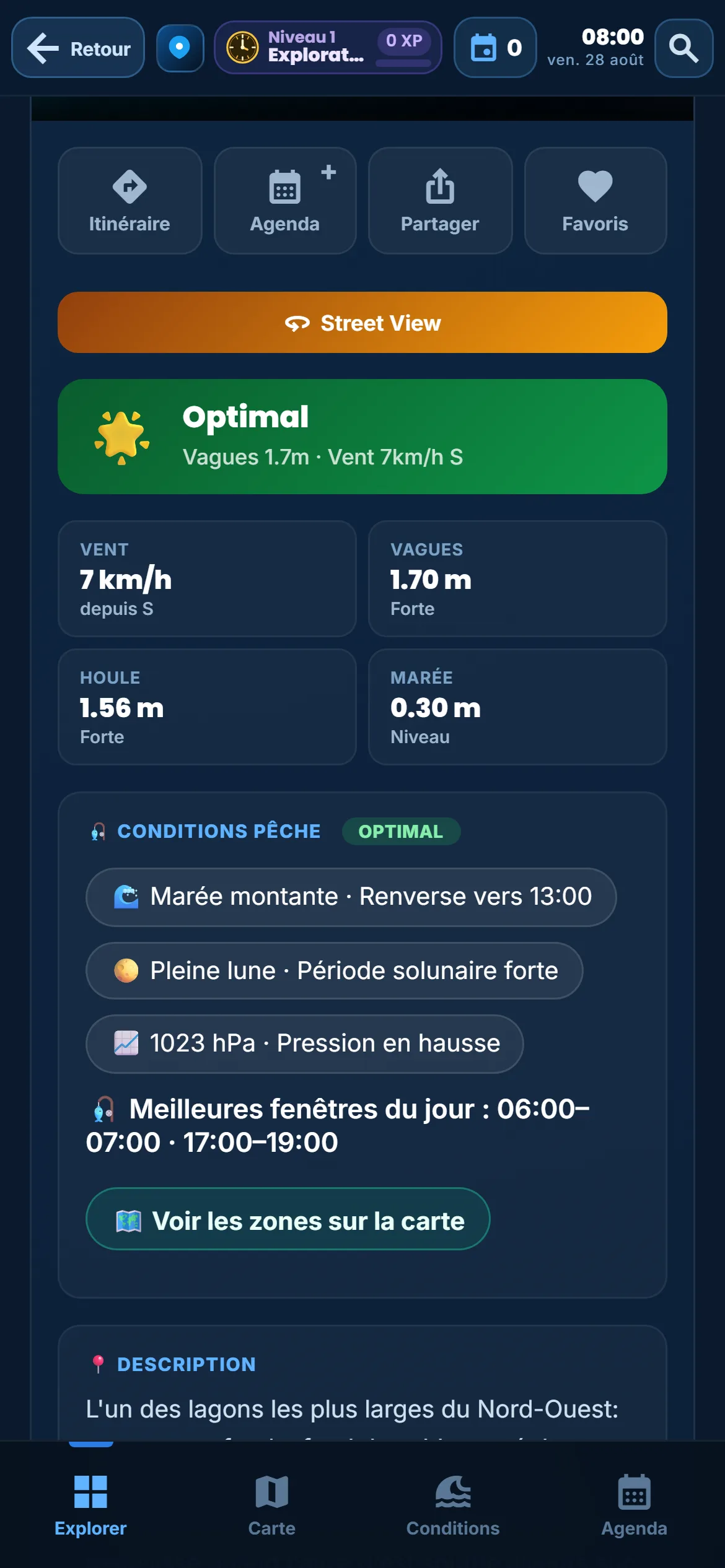
Everything described so far answers "how is it right now?". What remains is the question that really saves time: "what hour should I be there today?". That is the job of the "Best windows of the day" line, and it is included in the app like the rest of fishing mode.
Here is exactly what it does. The app replays the full calculation — tide, moon, pressure, light — for every hour of the current day, not just for the present moment. That gives it a curve of scores from morning to evening. It then keeps the stretches that clear a threshold, and that threshold moves: it never falls below seventy, but it climbs to the level of the top quarter of the day’s hours. The nuance matters — on a broadly excellent day the app does not hand you eight unusable slots, it hands you the best ones of that day. Two windows at most are shown, in chronological order, as a time range.
I would rather say so plainly than let you find out at the wrong moment — the same logic applies to the quietest beaches on the island. Conditions for the present moment stay readable in the app.
What fishing mode cannot do
This is the part I care most about writing, because a feature that promises too much always turns on whoever coded it.
Fishing mode does not predict fish. It works out physical conditions — tide, moon, pressure, light — and nothing else. It has no idea whether the shoal came through this morning, whether the water is loaded after overnight rain, whether the wind has turned in the past hour, or what your rig is worth. A score of ninety-five out of a hundred does not say "you will catch something": it says "the parameters I can measure are well lined up".
The calculation covers a zone, not a point. Tide and pressure are taken at regional scale, not to the metre on your pass. Two neighbouring spots on the same coast therefore share the same base score: the app points you to the right sector and the right hour, it does not replace close knowledge of a place.
And it does not replace a skipper. For big-game fishing, as for any trip offshore, safety, live marine weather and the rules remain the business of the island’s professionals. If what you want is the best seasons of the year and the species to target, that is a different subject, covered separately in our guide to fishing in Mauritius.
So fishing mode answers one precise question, and only one: among today’s hours, which are best placed? For the rest — the shape of the trip, the places to see, the tables — the full guide sits elsewhere in the app, and our 7-day Mauritius itinerary gives a solid frame to anyone landing for the first time.
Head out at the right hour
Tide, moon and pressure for your region in the app. Hour-by-hour windows are in the app.
Discover the app →