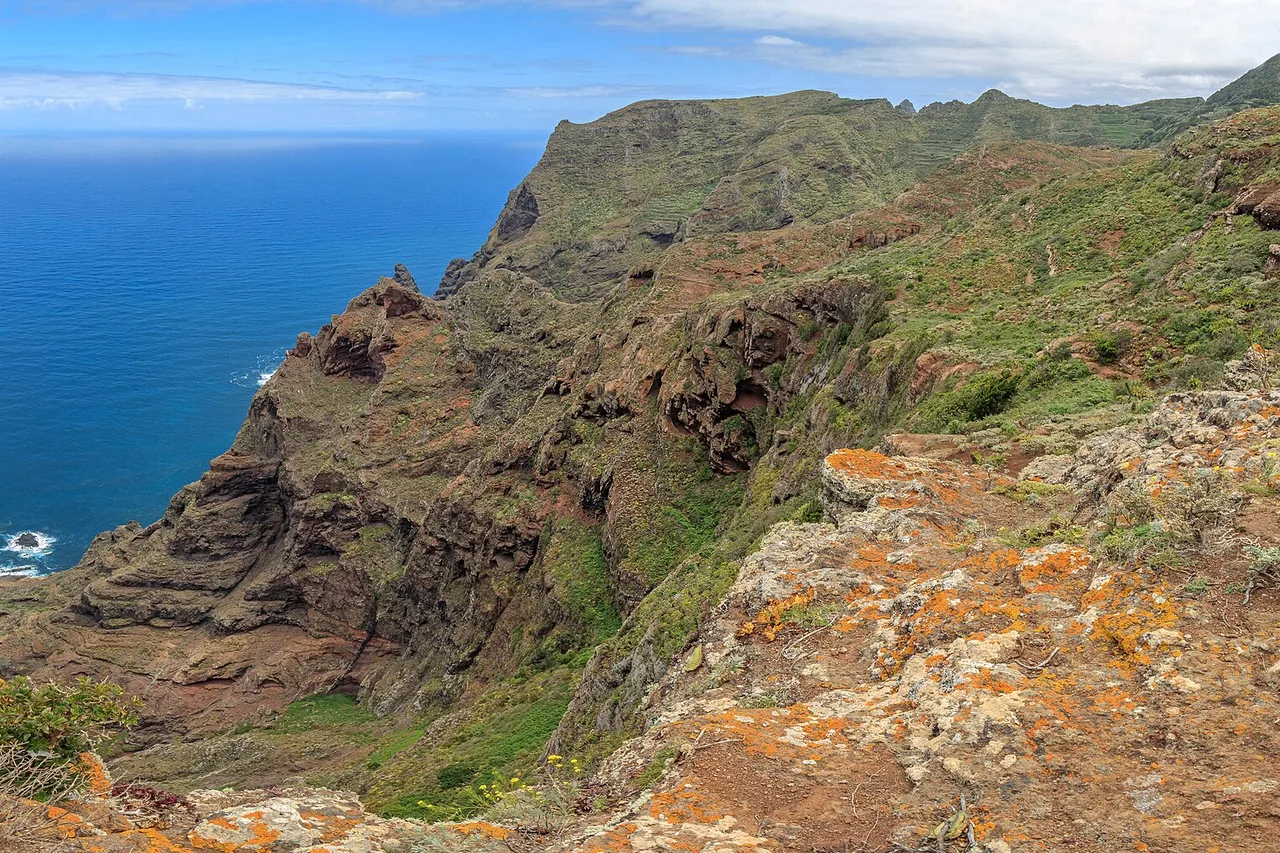
Tenerife is famous for its beaches and its carnival — but ask a local what makes the island truly special, and they will talk about trails. Within a forty-five-minute drive you go from the cactus-dry south to a laurel forest dripping with mist, then up to a lava desert floating 2,000 metres above the clouds. Few places in Europe pack so many worlds into so few kilometres, and walking is still the best way to cross them. This guide gathers the island's finest hikes — from Anaga to Mount Teide, via Masca and the Barranco del Infierno — together with what has changed recently: permits, daily quotas and prices, all verified at publication on 15 September 2026. Because that is the price of fame: the island's most celebrated trails now require booking, sometimes weeks ahead.
One Island, Four Storeys of Landscape
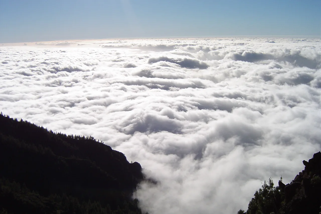
To pick the right trail, you first need to understand how the island works. The trade winds push clouds against the northern slopes almost all year round: between roughly 600 and 1,500 metres they form the famous sea of clouds that waters the laurisilva, a laurel forest inherited from the Tertiary era. Above it come the pine woods, and past 2,000 metres the volcanic desert of the Las Cañadas caldera, where little grows but broom. The south, meanwhile, stays dry and sunny nearly all the time. The practical consequence for hikers: you choose your trail by altitude band and by the day's weather. A clouded-in north rules out neither Teide nor the south; a heatwave at sea level is escaped uphill or under the laurels. Two slopes, two climates — it is the island's first rule, and your best insurance against a wasted day.
Anaga: the Primeval Forest and the Trail of Trails
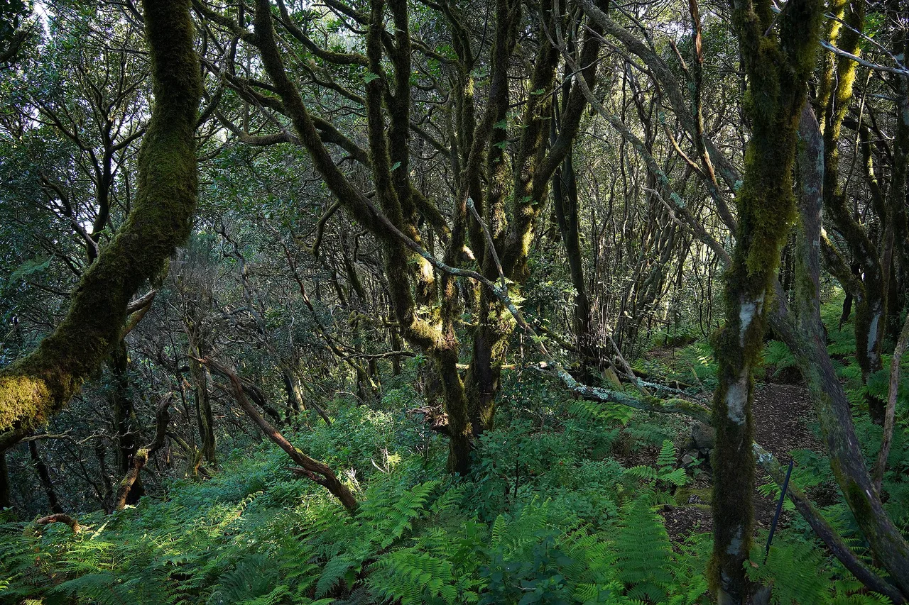
At the island's north-eastern tip, the Anaga massif is Tenerife's oldest corner — and a UNESCO Biosphere Reserve. This is where the island's finest laurisilva survives: moss-covered laurels twisted by the wind, giant ferns, and a mist that filters the light like a cathedral. The classic gateway is the Cruz del Carmen pass and its visitor centre: the Sendero de los Sentidos, the “trail of the senses”, unrolls three short family loops through the forest — an hour's outing, with the first loop manageable even with an all-terrain pushchair.
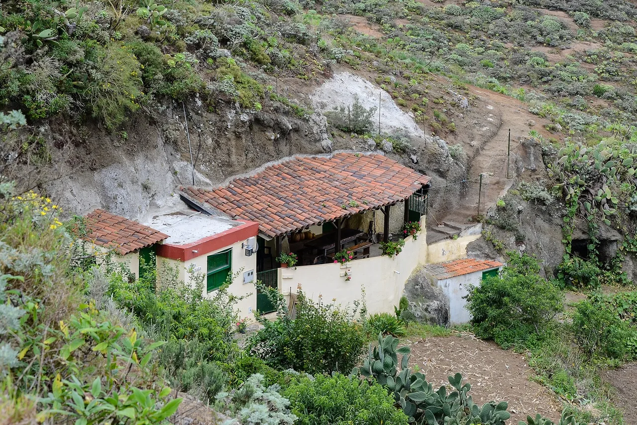
The great classic is the PR-TF 10: from Cruz del Carmen it descends every storey of the massif down to the ocean, via Chinamada and its still-inhabited cave houses dug into the tuff at around 600 metres, before the spectacular finale — a path carved into the cliff face dropping to Punta del Hidalgo. Allow half a day, downhill by preference; at the bottom, buses 050 and 105 run back to La Laguna and Santa Cruz. A more secret jewel, El Pijaral — nicknamed the “enchanted forest” — has to be earned: access requires a free permit, capped at 45 visitors per day, booked on the Cabildo's platform (centralreservas.tenerife.es or the Tenerife ON app). Slots open every Monday at 7am Canary time for dates 14 to 56 days ahead — and weekends vanish fast. For a full day in the massif, villages included, our dedicated Anaga Rural Park guide covers routes and access.
Mount Teide: Earning the Roof of Spain
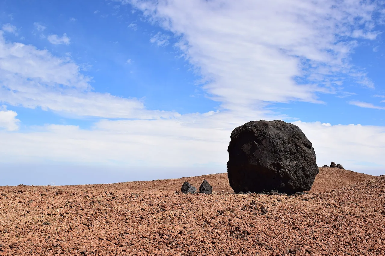
At 3,718 metres, Teide is Spain's highest point, and its ascent the most coveted hike in the archipelago. Two schools of thought. The first takes the cable car (€42 return) up to La Rambleta at 3,555 metres. The second walks up trail PNT-07 from the Montaña Blanca car park on the TF-21: around 1,400 metres of ascent past the “Teide eggs”, those black lava balls perched on ochre slopes. Nothing technical in fair weather, but the altitude slows every step, there is not a single tree of shade, and the wind can cut the day short.
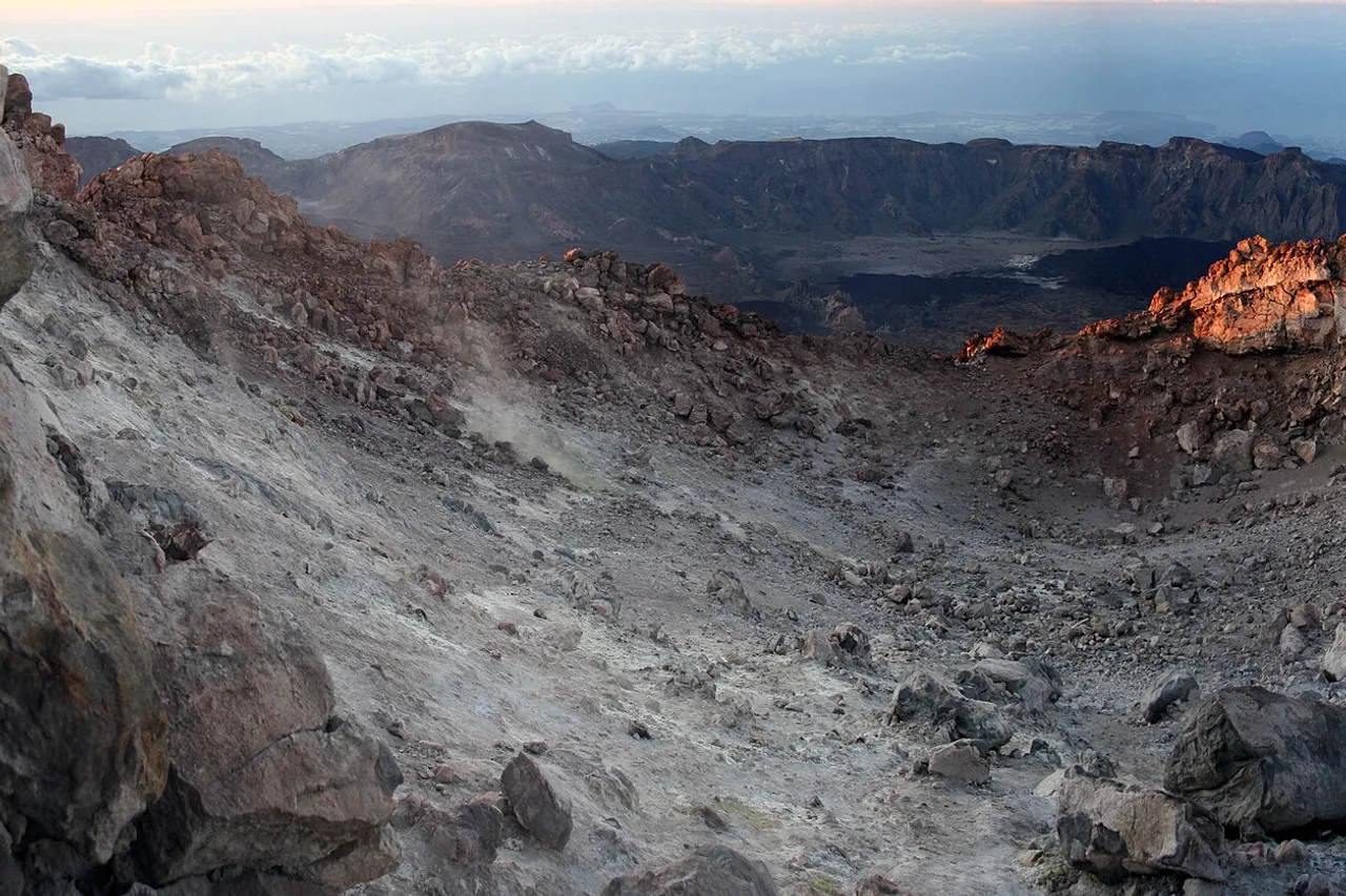
For the final 163 metres — the crater itself, via trail PNT-10 “Telesforo Bravo” — you need a named permit. Be aware the rules have changed: the summit permit, long free of charge, became a paid one in 2026 — €15 for non-residents, €6 for residents of the other Canary Islands, free for Tenerife residents and under-14s. Places are released every Monday at 7am (Canary time), at most 56 days ahead, and weekend slots go within minutes. One hard-earned tip: the cable car shuts down as soon as the wind picks up — whoever goes up, on foot or by cabin, must be able to walk back down. Our full Mount Teide climbing guide covers permits, timings and variants.
Masca: the Legendary Descent, Now Tightly Managed
The Masca gorge remains the island's most famous descent: 5 kilometres of ravine between dizzying walls, from the perched village (750 metres) down to a cove on the Atlantic — about 4 hours of descent, rated difficult, on uneven ground of steps and boulders. Since its reopening everything is regulated, and the gorge is better for it. Booking is mandatory (€40.66 per adult, free for Canary Islands residents), start slots run from 8.30am to 1pm, and in the current phase the walk is downhill only: you leave by boat to Los Gigantes, with a separate ticket to book. The village is reached only by Titsa bus 355 from Santiago del Teide — private vehicles are excluded from the scheme — and you must report to the visitor centre 30 minutes before your slot. At the checkpoint, closed hiking boots are required (sandals mean refused entry), a helmet is provided, and the rules impose a minimum of 1.5 litres of water per person. Opening days vary with the season: check them when booking on the official platform.
Barranco del Infierno and the Other Fine Surprises
Above the old town of Adeje, the Barranco del Infierno — “Hell's Gorge”, which could hardly be more misnamed — offers the south's most accessible managed hike: 6.5 kilometres return, moderate difficulty, to a waterfall of some 200 metres deep inside a nature reserve. Here too, a quota: 300 people per day, mandatory online booking (barrancodelinfierno.es), entries from 8am to 2.30pm, trail closed at 6pm. Expect €15 per adult, €7.50 for children aged 5 to 12 — under-5s are not admitted — and €5 for Canary residents. Helmet provided, and a genuine canyon feel twenty minutes from the resorts.
Three more classics earn their place in any trip. The Chinyero loop, easy and shaded by pines, circles the volcano of the island's last eruption (1909), black lava flows against green pinewood. The Paisaje Lunar above Vilaflor lines up its white tuff chimneys sculpted by erosion — a landscape from another planet on the caldera's rim. And for a gentle oceanside walk, the Rambla de Castro near Los Realejos winds between palm groves, cliffs and an old fort, with the Atlantic below you from first step to last.
Seasons, Kit and Common Sense
Tenerife is a year-round hiking island — one of its superpowers, laid out in our guide to the best time to visit Tenerife. Summer means early starts and aiming high or into the laurisilva, kept cool by the trade winds; winter can dust Teide with snow and temporarily close trails or the cable car — check the park's status the day before. The kit list fits on one line: proper boots, plenty of water (three litres per person on Teide), sunscreen and a hat, and a windproof layer even in August — at 3,700 metres, dawn is freezing while the beach reads 28°C. Always keep a plan B on the other slope: the cloud sea that spoils Anaga usually makes the caldera's day. And respect the quotas and bookings — they protect exactly what you came to see. To slot these hikes into a full trip, our 7-day itinerary spreads them by area, and the trip cost guide prices the rest.